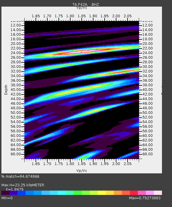
P42A Winchester, IL, USA - Earthquake Result Viewer
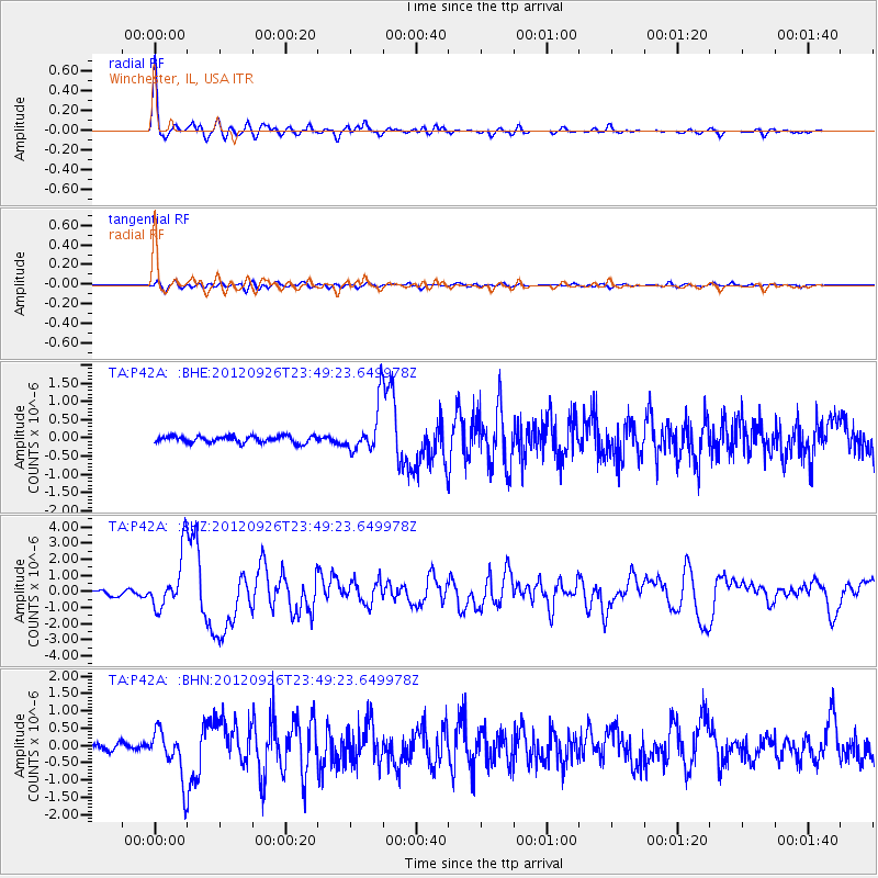
Earthquake location: Andreanof Islands, Aleutian Is.
Earthquake latitude/longitude: 51.6/-178.3
Earthquake time(UTC): 2012/09/26 (270) 23:39:55 GMT
Earthquake Depth: 16 km
Earthquake Magnitude: 6.3 MB, 6.5 MS, 6.4 MW, 6.4 MW
Earthquake Catalog/Contributor: WHDF/NEIC
Network: TA USArray Transportable Network (new EarthScope stations)
Station: P42A Winchester, IL, USA
Lat/Lon: 39.59 N/90.34 W
Elevation: 197 m
Distance: 59.1 deg
Az: 64.14 deg
Baz: 313.414 deg
Ray Param: 0.062386937
Estimated Moho Depth: 23.25 km
Estimated Crust Vp/Vs: 1.85
Assumed Crust Vp: 6.498 km/s
Estimated Crust Vs: 3.517 km/s
Estimated Crust Poisson's Ratio: 0.29
Radial Match: 94.674866 %
Radial Bump: 361
Transverse Match: 66.98946 %
Transverse Bump: 400
SOD ConfigId: 478790
Insert Time: 2013-02-22 23:30:14.759 +0000
GWidth: 2.5
Max Bumps: 400
Tol: 0.001

Signal To Noise

ChannelStoNSTALTA
TA:P42A: :BHZ:20120926T23:49:23.649978Z14.40292551.7129446E-61.1893032E-7
TA:P42A: :BHN:20120926T23:49:23.649978Z8.11523156.907243E-78.511455E-8
TA:P42A: :BHE:20120926T23:49:23.649978Z7.18155346.451764E-78.9838E-8
Arrivals
Ps3.2 SECOND
PpPs9.7 SECOND
PsPs/PpSs13 SECOND