U42A Revenden, AR, USA - Earthquake Result Viewer
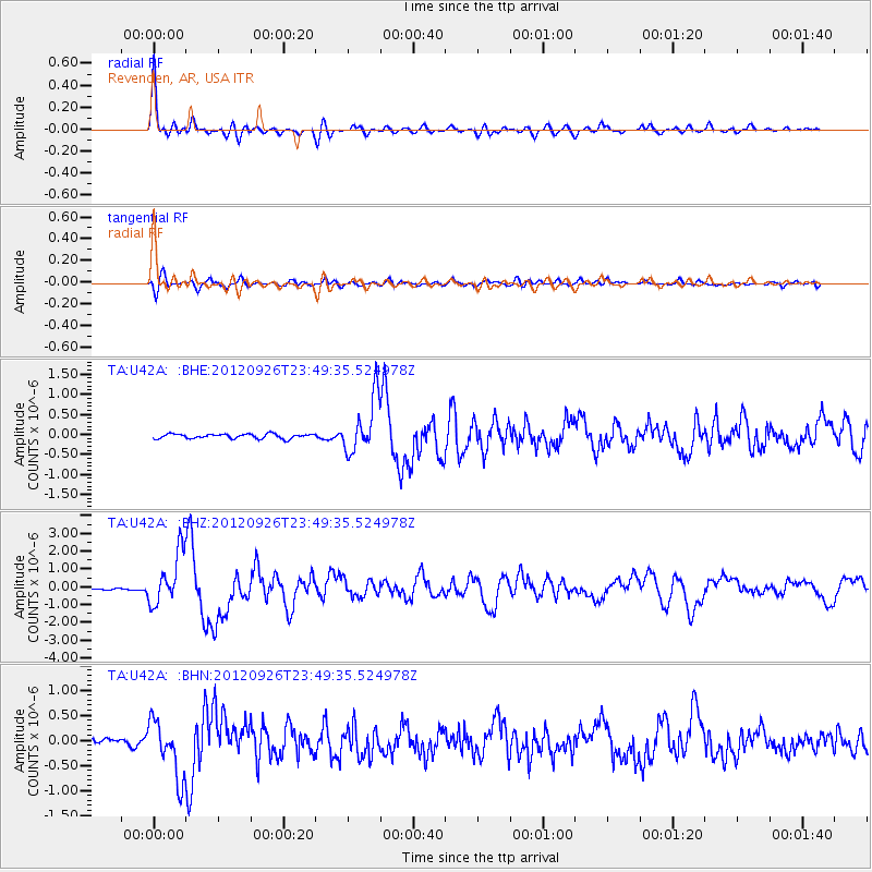
Earthquake location: Andreanof Islands, Aleutian Is.
Earthquake latitude/longitude: 51.6/-178.3
Earthquake time(UTC): 2012/09/26 (270) 23:39:55 GMT
Earthquake Depth: 16 km
Earthquake Magnitude: 6.3 MB, 6.5 MS, 6.4 MW, 6.4 MW
Earthquake Catalog/Contributor: WHDF/NEIC
Network: TA USArray Transportable Network (new EarthScope stations)
Station: U42A Revenden, AR, USA
Lat/Lon: 36.35 N/91.24 W
Elevation: 119 m
Distance: 60.8 deg
Az: 67.391 deg
Baz: 314.492 deg
Ray Param: 0.061246704
Estimated Moho Depth: 44.75 km
Estimated Crust Vp/Vs: 1.89
Assumed Crust Vp: 6.53 km/s
Estimated Crust Vs: 3.455 km/s
Estimated Crust Poisson's Ratio: 0.31
Radial Match: 93.098366 %
Radial Bump: 400
Transverse Match: 69.48382 %
Transverse Bump: 400
SOD ConfigId: 478790
Insert Time: 2013-02-22 23:30:28.294 +0000
GWidth: 2.5
Max Bumps: 400
Tol: 0.001

Signal To Noise

ChannelStoNSTALTA
TA:U42A: :BHZ:20120926T23:49:35.524978Z17.2366541.4509087E-68.4175774E-8
TA:U42A: :BHN:20120926T23:49:35.524978Z6.6109565.6648344E-78.5688576E-8
TA:U42A: :BHE:20120926T23:49:35.524978Z11.9820076.748701E-75.6323625E-8
Arrivals
Ps6.4 SECOND
PpPs19 SECOND
PsPs/PpSs25 SECOND