U41A Viola, AR, USA - Earthquake Result Viewer
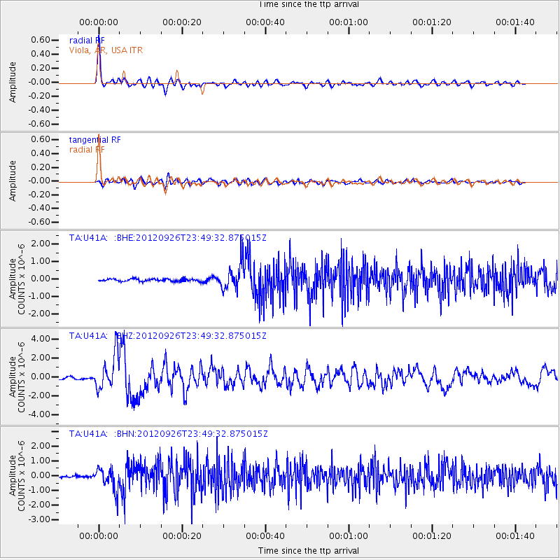
Earthquake location: Andreanof Islands, Aleutian Is.
Earthquake latitude/longitude: 51.6/-178.3
Earthquake time(UTC): 2012/09/26 (270) 23:39:55 GMT
Earthquake Depth: 16 km
Earthquake Magnitude: 6.3 MB, 6.5 MS, 6.4 MW, 6.4 MW
Earthquake Catalog/Contributor: WHDF/NEIC
Network: TA USArray Transportable Network (new EarthScope stations)
Station: U41A Viola, AR, USA
Lat/Lon: 36.34 N/91.92 W
Elevation: 300 m
Distance: 60.5 deg
Az: 67.839 deg
Baz: 314.309 deg
Ray Param: 0.061503347
Estimated Moho Depth: 27.5 km
Estimated Crust Vp/Vs: 1.98
Assumed Crust Vp: 6.53 km/s
Estimated Crust Vs: 3.298 km/s
Estimated Crust Poisson's Ratio: 0.33
Radial Match: 94.8979 %
Radial Bump: 400
Transverse Match: 77.62167 %
Transverse Bump: 400
SOD ConfigId: 478790
Insert Time: 2013-02-22 23:30:39.438 +0000
GWidth: 2.5
Max Bumps: 400
Tol: 0.001

Signal To Noise

ChannelStoNSTALTA
TA:U41A: :BHZ:20120926T23:49:32.875015Z20.8435231.9177378E-69.200641E-8
TA:U41A: :BHN:20120926T23:49:32.875015Z8.3923867.7105625E-79.187569E-8
TA:U41A: :BHE:20120926T23:49:32.875015Z10.788237.7291475E-77.164426E-8
Arrivals
Ps4.3 SECOND
PpPs12 SECOND
PsPs/PpSs16 SECOND