T44A Benton, MO, USA - Earthquake Result Viewer
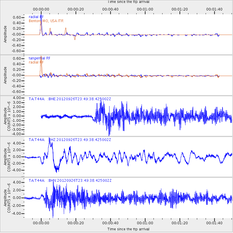
Earthquake location: Andreanof Islands, Aleutian Is.
Earthquake latitude/longitude: 51.6/-178.3
Earthquake time(UTC): 2012/09/26 (270) 23:39:55 GMT
Earthquake Depth: 16 km
Earthquake Magnitude: 6.3 MB, 6.5 MS, 6.4 MW, 6.4 MW
Earthquake Catalog/Contributor: WHDF/NEIC
Network: TA USArray Transportable Network (new EarthScope stations)
Station: T44A Benton, MO, USA
Lat/Lon: 37.09 N/89.59 W
Elevation: 133 m
Distance: 61.3 deg
Az: 65.732 deg
Baz: 314.671 deg
Ray Param: 0.060963128
Estimated Moho Depth: 35.5 km
Estimated Crust Vp/Vs: 1.83
Assumed Crust Vp: 6.444 km/s
Estimated Crust Vs: 3.516 km/s
Estimated Crust Poisson's Ratio: 0.29
Radial Match: 95.452675 %
Radial Bump: 258
Transverse Match: 67.850105 %
Transverse Bump: 400
SOD ConfigId: 478790
Insert Time: 2013-02-22 23:30:42.699 +0000
GWidth: 2.5
Max Bumps: 400
Tol: 0.001

Signal To Noise

ChannelStoNSTALTA
TA:T44A: :BHZ:20120926T23:49:38.425002Z11.8707061.8934642E-61.595073E-7
TA:T44A: :BHN:20120926T23:49:38.425002Z8.6262071.0832106E-61.2557206E-7
TA:T44A: :BHE:20120926T23:49:38.425002Z7.8567941.3133554E-61.6716174E-7
Arrivals
Ps4.8 SECOND
PpPs15 SECOND
PsPs/PpSs20 SECOND