R42A Luebbering, MO, USA - Earthquake Result Viewer
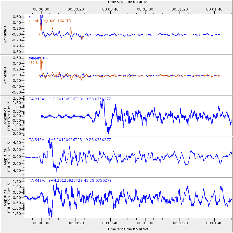
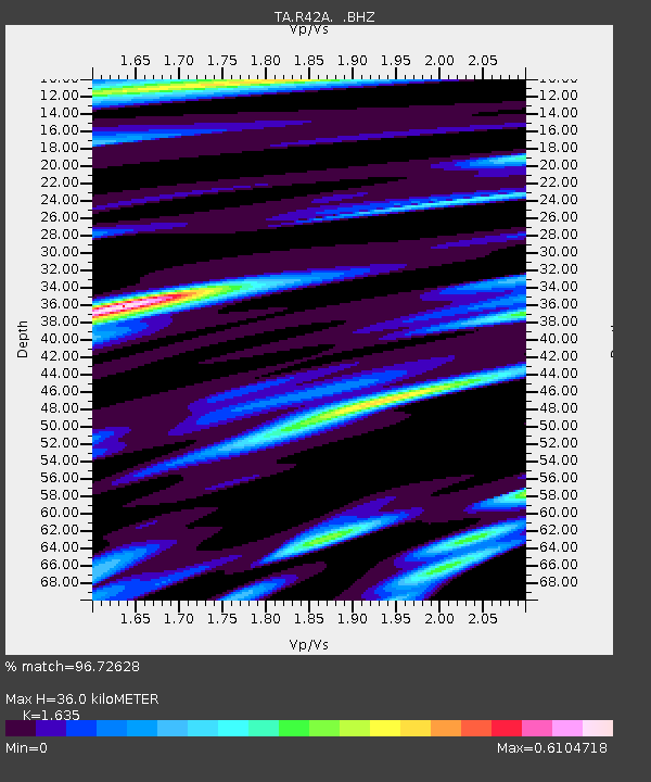
Earthquake location: Andreanof Islands, Aleutian Is.
Earthquake latitude/longitude: 51.6/-178.3
Earthquake time(UTC): 2012/09/26 (270) 23:39:55 GMT
Earthquake Depth: 16 km
Earthquake Magnitude: 6.3 MB, 6.5 MS, 6.4 MW, 6.4 MW
Earthquake Catalog/Contributor: WHDF/NEIC
Network: TA USArray Transportable Network (new EarthScope stations)
Station: R42A Luebbering, MO, USA
Lat/Lon: 38.28 N/90.79 W
Elevation: 218 m
Distance: 59.8 deg
Az: 65.517 deg
Baz: 313.832 deg
Ray Param: 0.061961904
Estimated Moho Depth: 36.0 km
Estimated Crust Vp/Vs: 1.63
Assumed Crust Vp: 6.498 km/s
Estimated Crust Vs: 3.974 km/s
Estimated Crust Poisson's Ratio: 0.20
Radial Match: 96.72628 %
Radial Bump: 370
Transverse Match: 72.816864 %
Transverse Bump: 400
SOD ConfigId: 478790
Insert Time: 2013-02-22 23:31:07.426 +0000
GWidth: 2.5
Max Bumps: 400
Tol: 0.001

Signal To Noise

ChannelStoNSTALTA
TA:R42A: :BHZ:20120926T23:49:28.075027Z25.0440272.0862356E-68.3302716E-8
TA:R42A: :BHN:20120926T23:49:28.075027Z6.14106135.8580974E-79.539227E-8
TA:R42A: :BHE:20120926T23:49:28.075027Z8.3227197.0586697E-78.4812065E-8
Arrivals
Ps3.7 SECOND
PpPs14 SECOND
PsPs/PpSs18 SECOND