H40A Chili, WI, USA - Earthquake Result Viewer
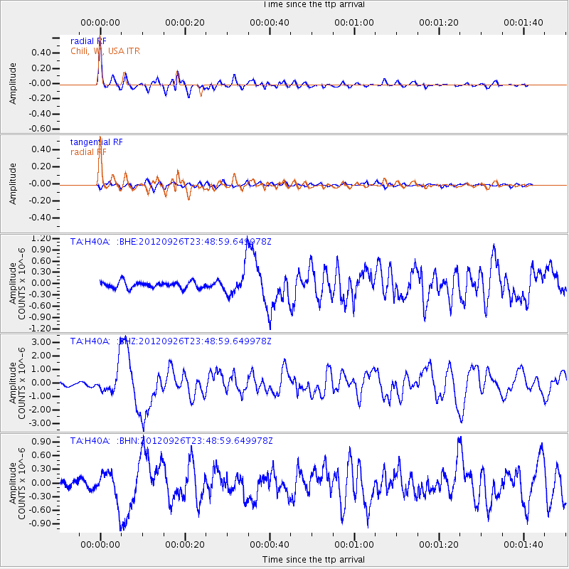
Earthquake location: Andreanof Islands, Aleutian Is.
Earthquake latitude/longitude: 51.6/-178.3
Earthquake time(UTC): 2012/09/26 (270) 23:39:55 GMT
Earthquake Depth: 16 km
Earthquake Magnitude: 6.3 MB, 6.5 MS, 6.4 MW, 6.4 MW
Earthquake Catalog/Contributor: WHDF/NEIC
Network: TA USArray Transportable Network (new EarthScope stations)
Station: H40A Chili, WI, USA
Lat/Lon: 44.62 N/90.39 W
Elevation: 372 m
Distance: 55.7 deg
Az: 59.744 deg
Baz: 311.013 deg
Ray Param: 0.06460322
Estimated Moho Depth: 44.75 km
Estimated Crust Vp/Vs: 1.85
Assumed Crust Vp: 6.571 km/s
Estimated Crust Vs: 3.547 km/s
Estimated Crust Poisson's Ratio: 0.29
Radial Match: 89.90524 %
Radial Bump: 400
Transverse Match: 67.111145 %
Transverse Bump: 400
SOD ConfigId: 478790
Insert Time: 2013-02-22 23:32:11.077 +0000
GWidth: 2.5
Max Bumps: 400
Tol: 0.001

Signal To Noise

ChannelStoNSTALTA
TA:H40A: :BHZ:20120926T23:48:59.649978Z7.6451871.0914567E-61.427639E-7
TA:H40A: :BHN:20120926T23:48:59.649978Z3.69336533.5266132E-79.5485085E-8
TA:H40A: :BHE:20120926T23:48:59.649978Z5.0345524.204193E-78.350679E-8
Arrivals
Ps6.1 SECOND
PpPs18 SECOND
PsPs/PpSs25 SECOND