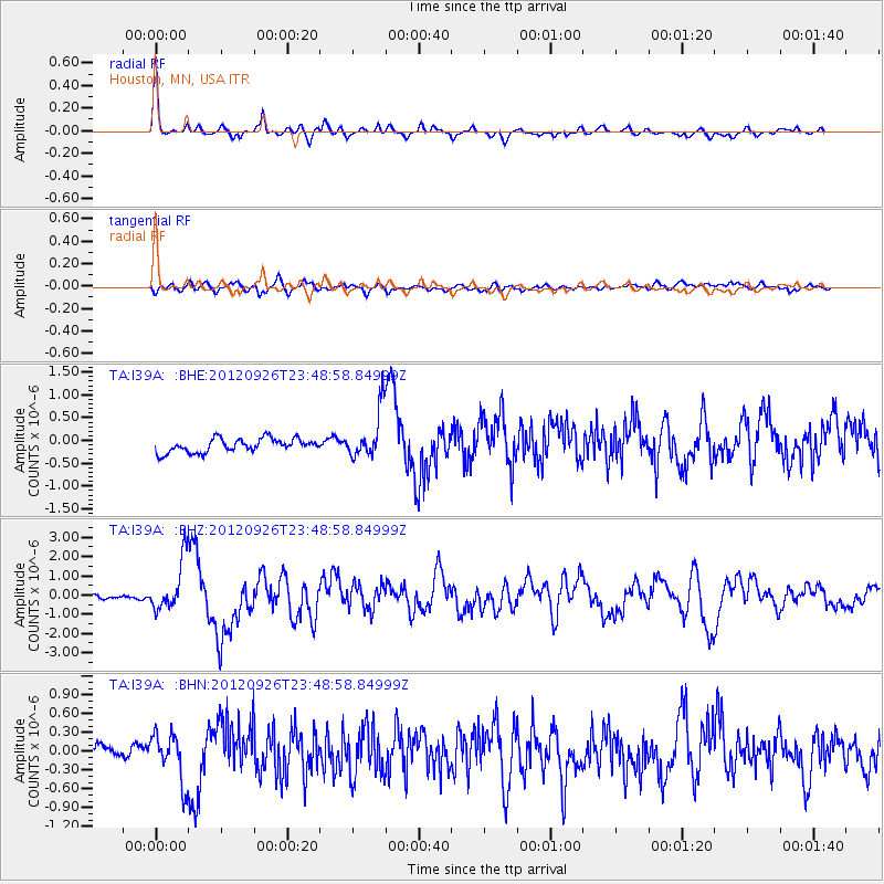
I39A Houston, MN, USA - Earthquake Result Viewer
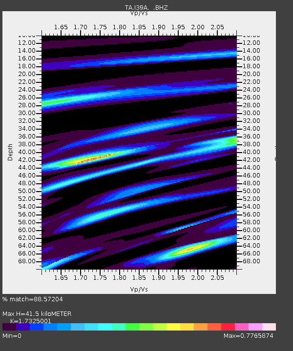
Earthquake location: Andreanof Islands, Aleutian Is.
Earthquake latitude/longitude: 51.6/-178.3
Earthquake time(UTC): 2012/09/26 (270) 23:39:55 GMT
Earthquake Depth: 16 km
Earthquake Magnitude: 6.3 MB, 6.5 MS, 6.4 MW, 6.4 MW
Earthquake Catalog/Contributor: WHDF/NEIC
Network: TA USArray Transportable Network (new EarthScope stations)
Station: I39A Houston, MN, USA
Lat/Lon: 43.85 N/91.52 W
Elevation: 393 m
Distance: 55.6 deg
Az: 61.092 deg
Baz: 310.986 deg
Ray Param: 0.064675406
Estimated Moho Depth: 41.5 km
Estimated Crust Vp/Vs: 1.73
Assumed Crust Vp: 6.53 km/s
Estimated Crust Vs: 3.769 km/s
Estimated Crust Poisson's Ratio: 0.25
Radial Match: 88.57204 %
Radial Bump: 307
Transverse Match: 57.312393 %
Transverse Bump: 400
SOD ConfigId: 478790
Insert Time: 2013-02-22 23:32:25.299 +0000
GWidth: 2.5
Max Bumps: 400
Tol: 0.001

Signal To Noise

ChannelStoNSTALTA
TA:I39A: :BHZ:20120926T23:48:58.84999Z12.2684381.3188674E-61.0750084E-7
TA:I39A: :BHN:20120926T23:48:58.84999Z3.67759443.8332448E-71.0423239E-7
TA:I39A: :BHE:20120926T23:48:58.84999Z3.58548455.340926E-71.4895966E-7
Arrivals
Ps4.9 SECOND
PpPs16 SECOND
PsPs/PpSs21 SECOND