H38A Maiden Rock, WI, USA - Earthquake Result Viewer
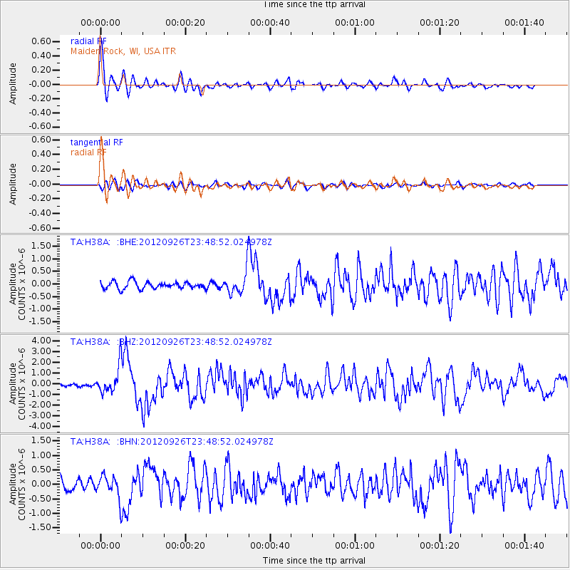
Earthquake location: Andreanof Islands, Aleutian Is.
Earthquake latitude/longitude: 51.6/-178.3
Earthquake time(UTC): 2012/09/26 (270) 23:39:55 GMT
Earthquake Depth: 16 km
Earthquake Magnitude: 6.3 MB, 6.5 MS, 6.4 MW, 6.4 MW
Earthquake Catalog/Contributor: WHDF/NEIC
Network: TA USArray Transportable Network (new EarthScope stations)
Station: H38A Maiden Rock, WI, USA
Lat/Lon: 44.68 N/92.28 W
Elevation: 333 m
Distance: 54.6 deg
Az: 60.766 deg
Baz: 310.272 deg
Ray Param: 0.065302595
Estimated Moho Depth: 56.75 km
Estimated Crust Vp/Vs: 1.60
Assumed Crust Vp: 6.571 km/s
Estimated Crust Vs: 4.107 km/s
Estimated Crust Poisson's Ratio: 0.18
Radial Match: 87.35805 %
Radial Bump: 400
Transverse Match: 60.42233 %
Transverse Bump: 400
SOD ConfigId: 478790
Insert Time: 2013-02-22 23:32:52.841 +0000
GWidth: 2.5
Max Bumps: 400
Tol: 0.001

Signal To Noise

ChannelStoNSTALTA
TA:H38A: :BHZ:20120926T23:48:52.024978Z6.86617041.2882089E-61.8761679E-7
TA:H38A: :BHN:20120926T23:48:52.024978Z2.20897533.8932103E-71.762451E-7
TA:H38A: :BHE:20120926T23:48:52.024978Z3.55415964.9896016E-71.4038766E-7
Arrivals
Ps5.5 SECOND
PpPs21 SECOND
PsPs/PpSs27 SECOND