
F39A Loretta, WI, USA - Earthquake Result Viewer
| ||||||||||||||||||
| ||||||||||||||||||
| ||||||||||||||||||
|
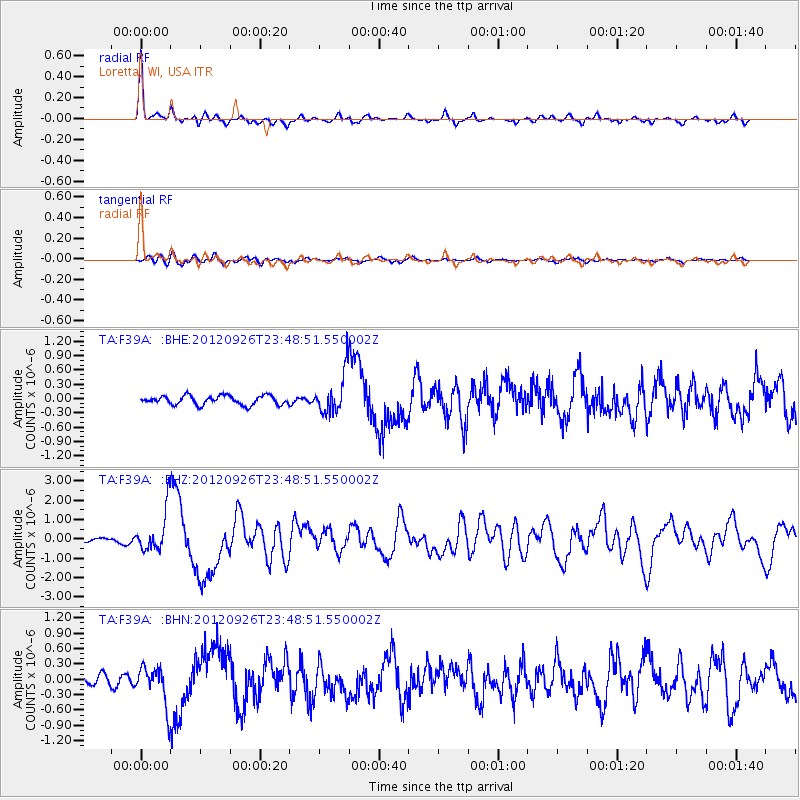
Signal To Noise
| Channel | StoN | STA | LTA |
| TA:F39A: :BHZ:20120926T23:48:51.550002Z | 8.609678 | 1.0722682E-6 | 1.245422E-7 |
| TA:F39A: :BHN:20120926T23:48:51.550002Z | 4.371011 | 3.8149534E-7 | 8.7278515E-8 |
| TA:F39A: :BHE:20120926T23:48:51.550002Z | 4.463973 | 4.191727E-7 | 9.390126E-8 |
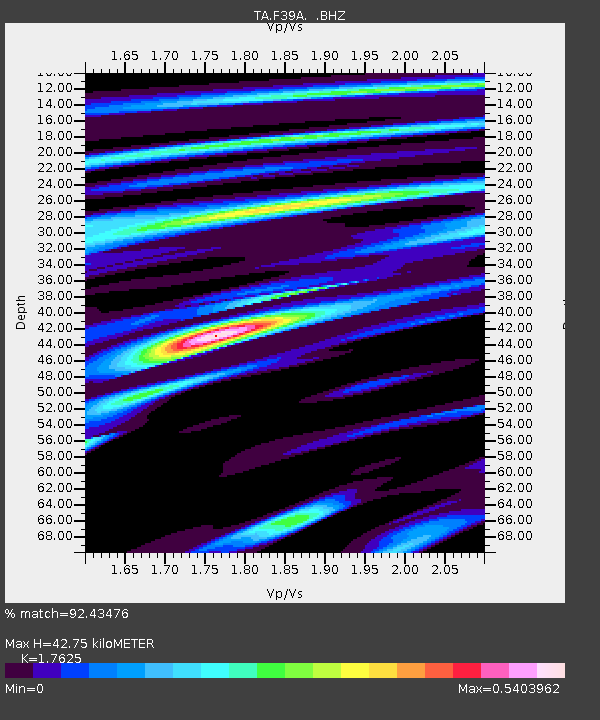
| Arrivals | |
| Ps | 5.2 SECOND |
| PpPs | 17 SECOND |
| PsPs/PpSs | 22 SECOND |

