
D41A Chassel, MI, USA - Earthquake Result Viewer
| ||||||||||||||||||
| ||||||||||||||||||
| ||||||||||||||||||
|
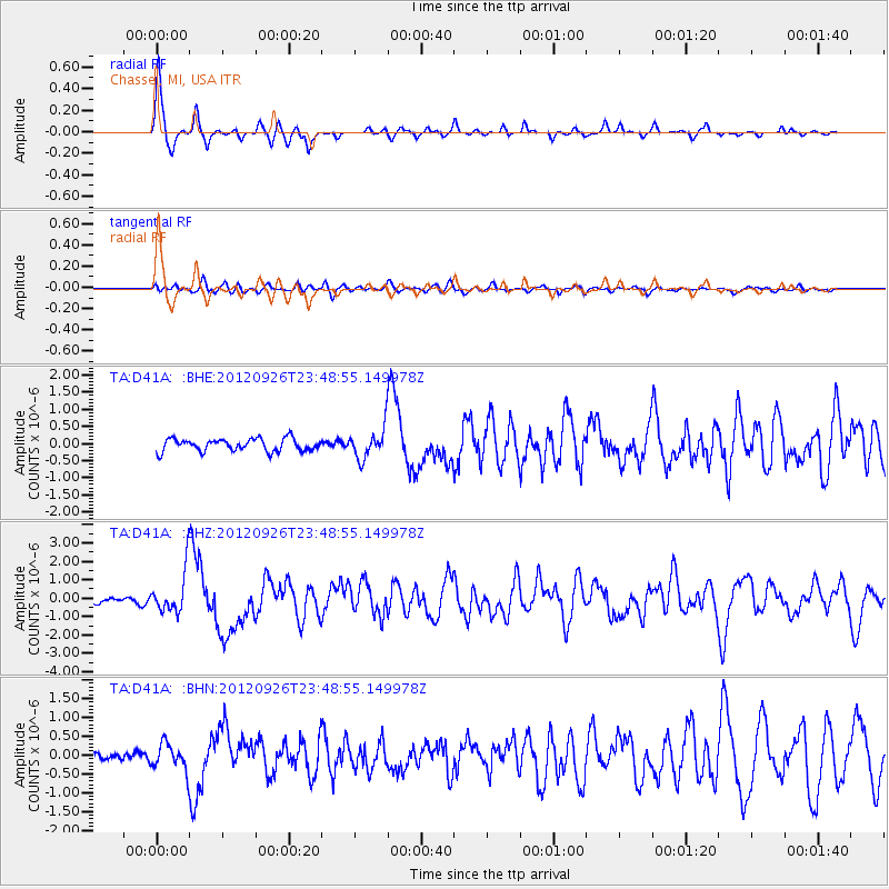
Signal To Noise
| Channel | StoN | STA | LTA |
| TA:D41A: :BHZ:20120926T23:48:55.149978Z | 5.11343 | 1.1364217E-6 | 2.2224255E-7 |
| TA:D41A: :BHN:20120926T23:48:55.149978Z | 1.5811626 | 3.4515054E-7 | 2.1828909E-7 |
| TA:D41A: :BHE:20120926T23:48:55.149978Z | 2.4381714 | 4.429136E-7 | 1.8165811E-7 |
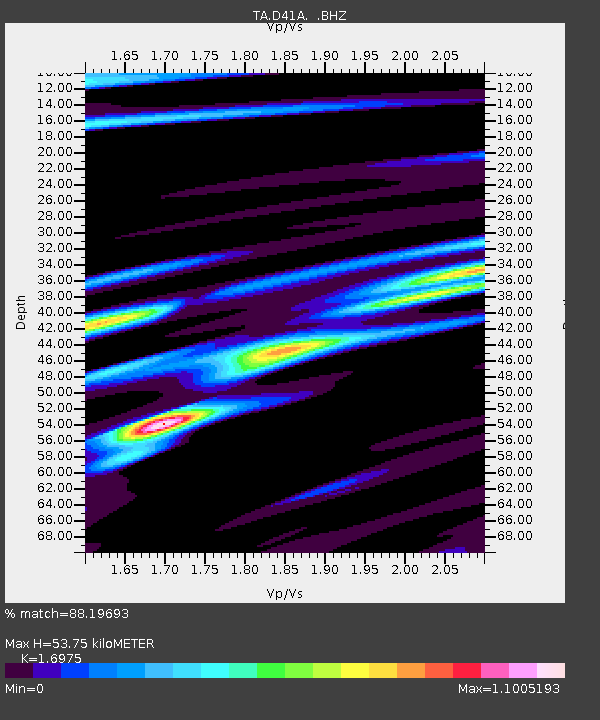
| Arrivals | |
| Ps | 6.1 SECOND |
| PpPs | 21 SECOND |
| PsPs/PpSs | 27 SECOND |

