G43A Wallace, MI, USA - Earthquake Result Viewer
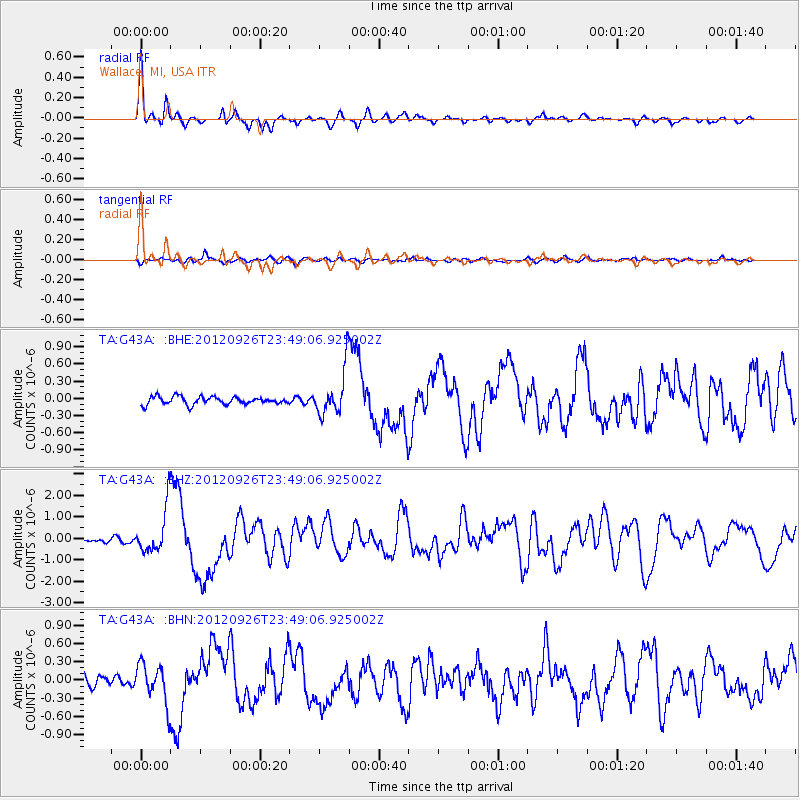
Earthquake location: Andreanof Islands, Aleutian Is.
Earthquake latitude/longitude: 51.6/-178.3
Earthquake time(UTC): 2012/09/26 (270) 23:39:55 GMT
Earthquake Depth: 16 km
Earthquake Magnitude: 6.3 MB, 6.5 MS, 6.4 MW, 6.4 MW
Earthquake Catalog/Contributor: WHDF/NEIC
Network: TA USArray Transportable Network (new EarthScope stations)
Station: G43A Wallace, MI, USA
Lat/Lon: 45.26 N/87.69 W
Elevation: 213 m
Distance: 56.7 deg
Az: 57.643 deg
Baz: 311.749 deg
Ray Param: 0.063937075
Estimated Moho Depth: 34.0 km
Estimated Crust Vp/Vs: 1.80
Assumed Crust Vp: 6.53 km/s
Estimated Crust Vs: 3.638 km/s
Estimated Crust Poisson's Ratio: 0.27
Radial Match: 91.702065 %
Radial Bump: 302
Transverse Match: 59.13139 %
Transverse Bump: 400
SOD ConfigId: 478790
Insert Time: 2013-02-22 23:35:18.149 +0000
GWidth: 2.5
Max Bumps: 400
Tol: 0.001

Signal To Noise

ChannelStoNSTALTA
TA:G43A: :BHZ:20120926T23:49:06.925002Z8.5302511.0503028E-61.2312684E-7
TA:G43A: :BHN:20120926T23:49:06.925002Z2.44469213.1229814E-71.2774538E-7
TA:G43A: :BHE:20120926T23:49:06.925002Z5.96689223.9782861E-76.667266E-8
Arrivals
Ps4.4 SECOND
PpPs14 SECOND
PsPs/PpSs18 SECOND