N46A Monticello, IN, USA - Earthquake Result Viewer
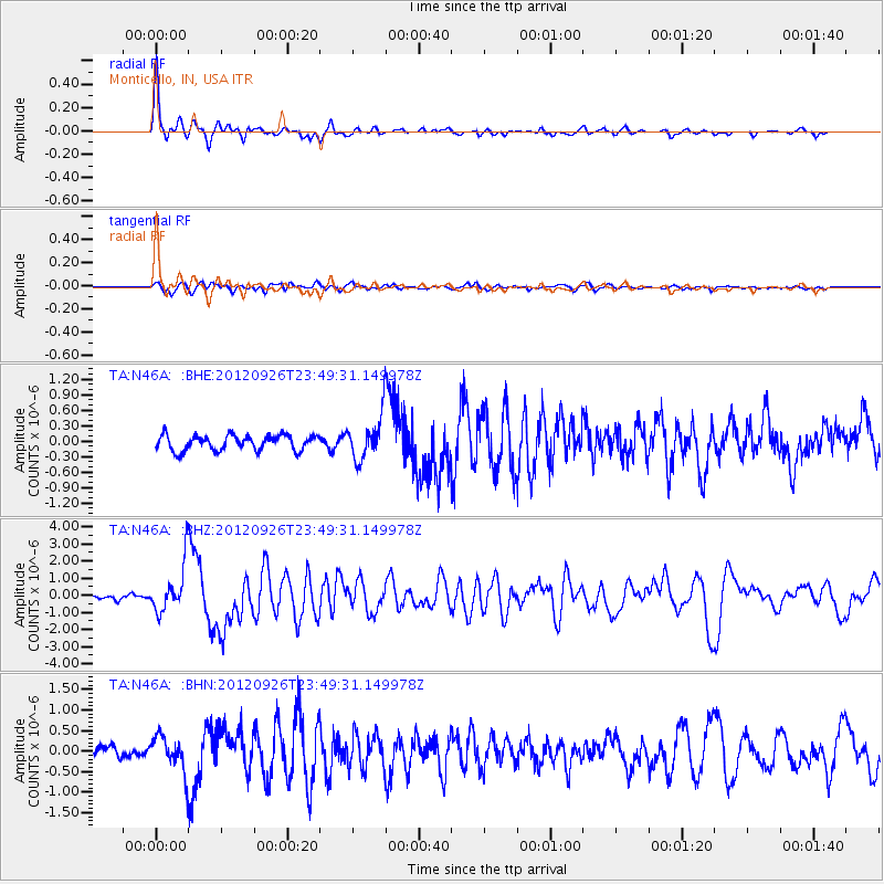
Earthquake location: Andreanof Islands, Aleutian Is.
Earthquake latitude/longitude: 51.6/-178.3
Earthquake time(UTC): 2012/09/26 (270) 23:39:55 GMT
Earthquake Depth: 16 km
Earthquake Magnitude: 6.3 MB, 6.5 MS, 6.4 MW, 6.4 MW
Earthquake Catalog/Contributor: WHDF/NEIC
Network: TA USArray Transportable Network (new EarthScope stations)
Station: N46A Monticello, IN, USA
Lat/Lon: 40.89 N/86.74 W
Elevation: 209 m
Distance: 60.2 deg
Az: 60.833 deg
Baz: 314.065 deg
Ray Param: 0.061670028
Estimated Moho Depth: 21.25 km
Estimated Crust Vp/Vs: 2.09
Assumed Crust Vp: 6.498 km/s
Estimated Crust Vs: 3.105 km/s
Estimated Crust Poisson's Ratio: 0.35
Radial Match: 93.40659 %
Radial Bump: 356
Transverse Match: 80.90905 %
Transverse Bump: 400
SOD ConfigId: 478790
Insert Time: 2013-02-22 23:36:27.874 +0000
GWidth: 2.5
Max Bumps: 400
Tol: 0.001

Signal To Noise

ChannelStoNSTALTA
TA:N46A: :BHZ:20120926T23:49:31.149978Z10.4238581.3821009E-61.3259015E-7
TA:N46A: :BHN:20120926T23:49:31.149978Z3.39308524.3686347E-71.2875111E-7
TA:N46A: :BHE:20120926T23:49:31.149978Z2.85926374.2356083E-71.4813632E-7
Arrivals
Ps3.7 SECOND
PpPs9.7 SECOND
PsPs/PpSs13 SECOND