J42A Columbus, WI, USA - Earthquake Result Viewer
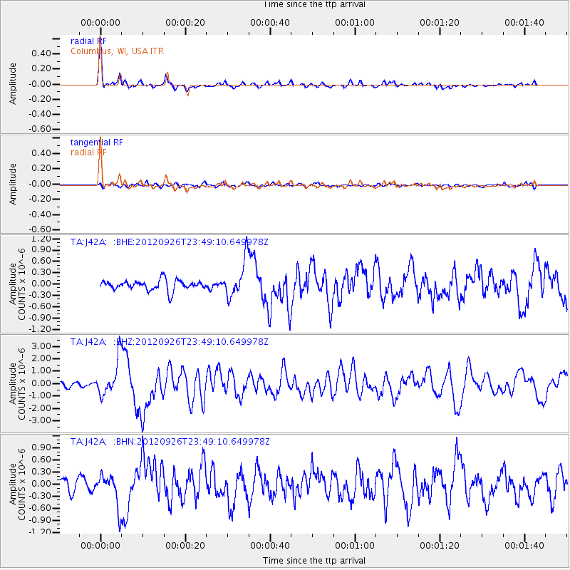
Earthquake location: Andreanof Islands, Aleutian Is.
Earthquake latitude/longitude: 51.6/-178.3
Earthquake time(UTC): 2012/09/26 (270) 23:39:55 GMT
Earthquake Depth: 16 km
Earthquake Magnitude: 6.3 MB, 6.5 MS, 6.4 MW, 6.4 MW
Earthquake Catalog/Contributor: WHDF/NEIC
Network: TA USArray Transportable Network (new EarthScope stations)
Station: J42A Columbus, WI, USA
Lat/Lon: 43.32 N/89.12 W
Elevation: 313 m
Distance: 57.3 deg
Az: 60.185 deg
Baz: 312.133 deg
Ray Param: 0.063592054
Estimated Moho Depth: 39.75 km
Estimated Crust Vp/Vs: 1.74
Assumed Crust Vp: 6.571 km/s
Estimated Crust Vs: 3.776 km/s
Estimated Crust Poisson's Ratio: 0.25
Radial Match: 91.87589 %
Radial Bump: 316
Transverse Match: 66.72324 %
Transverse Bump: 400
SOD ConfigId: 478790
Insert Time: 2013-02-22 23:36:40.725 +0000
GWidth: 2.5
Max Bumps: 400
Tol: 0.001

Signal To Noise

ChannelStoNSTALTA
TA:J42A: :BHZ:20120926T23:49:10.649978Z7.47951941.4485752E-61.9367224E-7
TA:J42A: :BHN:20120926T23:49:10.649978Z2.9604164.1127038E-71.3892317E-7
TA:J42A: :BHE:20120926T23:49:10.649978Z3.74097514.9884267E-71.3334562E-7
Arrivals
Ps4.7 SECOND
PpPs16 SECOND
PsPs/PpSs20 SECOND