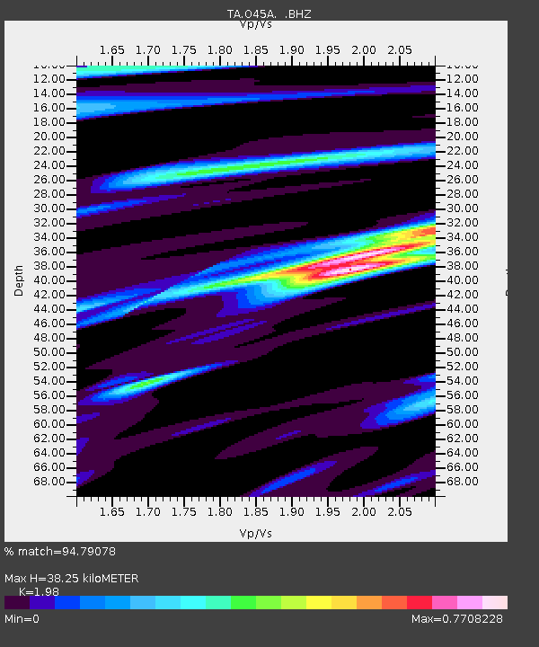
O45A Potomac, IL, USA - Earthquake Result Viewer
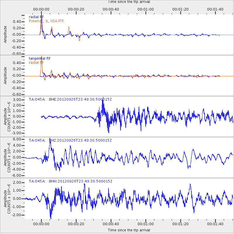
Earthquake location: Andreanof Islands, Aleutian Is.
Earthquake latitude/longitude: 51.6/-178.3
Earthquake time(UTC): 2012/09/26 (270) 23:39:55 GMT
Earthquake Depth: 16 km
Earthquake Magnitude: 6.3 MB, 6.5 MS, 6.4 MW, 6.4 MW
Earthquake Catalog/Contributor: WHDF/NEIC
Network: TA USArray Transportable Network (new EarthScope stations)
Station: O45A Potomac, IL, USA
Lat/Lon: 40.25 N/87.72 W
Elevation: 208 m
Distance: 60.1 deg
Az: 61.971 deg
Baz: 313.991 deg
Ray Param: 0.061731
Estimated Moho Depth: 38.25 km
Estimated Crust Vp/Vs: 1.98
Assumed Crust Vp: 6.498 km/s
Estimated Crust Vs: 3.282 km/s
Estimated Crust Poisson's Ratio: 0.33
Radial Match: 94.79078 %
Radial Bump: 298
Transverse Match: 80.25605 %
Transverse Bump: 400
SOD ConfigId: 478790
Insert Time: 2013-02-22 23:36:54.585 +0000
GWidth: 2.5
Max Bumps: 400
Tol: 0.001

Signal To Noise

ChannelStoNSTALTA
TA:O45A: :BHZ:20120926T23:49:30.500015Z10.9950961.5348597E-61.3959493E-7
TA:O45A: :BHN:20120926T23:49:30.500015Z3.92282964.979101E-71.2692625E-7
TA:O45A: :BHE:20120926T23:49:30.500015Z5.10364876.397075E-71.2534316E-7
Arrivals
Ps6.0 SECOND
PpPs17 SECOND
PsPs/PpSs23 SECOND