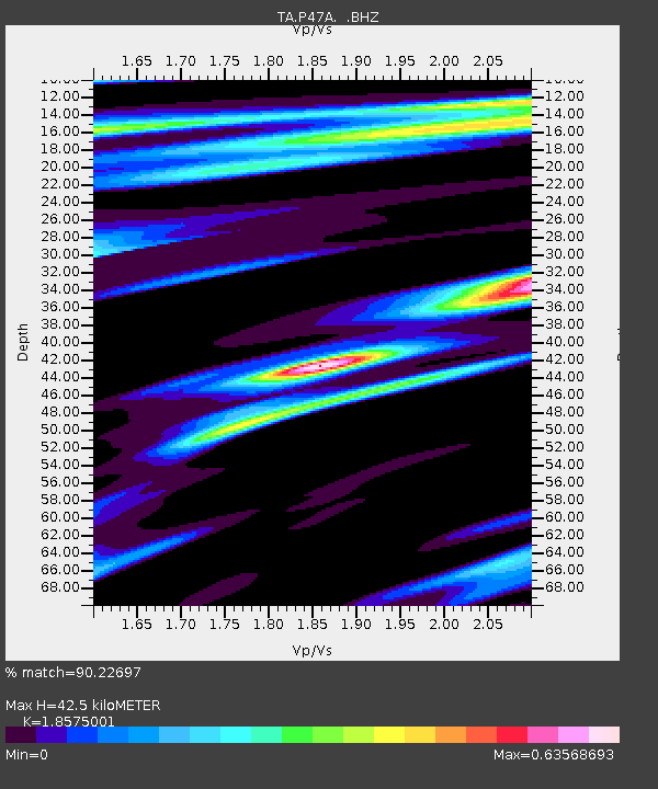
P47A Martinsville, IN, USA - Earthquake Result Viewer
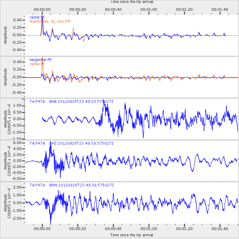
Earthquake location: Andreanof Islands, Aleutian Is.
Earthquake latitude/longitude: 51.6/-178.3
Earthquake time(UTC): 2012/09/26 (270) 23:39:55 GMT
Earthquake Depth: 16 km
Earthquake Magnitude: 6.3 MB, 6.5 MS, 6.4 MW, 6.4 MW
Earthquake Catalog/Contributor: WHDF/NEIC
Network: TA USArray Transportable Network (new EarthScope stations)
Station: P47A Martinsville, IN, USA
Lat/Lon: 39.49 N/86.27 W
Elevation: 246 m
Distance: 61.4 deg
Az: 61.697 deg
Baz: 314.786 deg
Ray Param: 0.060853418
Estimated Moho Depth: 42.5 km
Estimated Crust Vp/Vs: 1.86
Assumed Crust Vp: 6.444 km/s
Estimated Crust Vs: 3.469 km/s
Estimated Crust Poisson's Ratio: 0.30
Radial Match: 90.22697 %
Radial Bump: 323
Transverse Match: 81.8949 %
Transverse Bump: 400
SOD ConfigId: 478790
Insert Time: 2013-02-22 23:37:05.777 +0000
GWidth: 2.5
Max Bumps: 400
Tol: 0.001

Signal To Noise

ChannelStoNSTALTA
TA:P47A: :BHZ:20120926T23:49:39.575027Z13.7479382.0932569E-61.5225969E-7
TA:P47A: :BHN:20120926T23:49:39.575027Z4.9313787.0712144E-71.4339226E-7
TA:P47A: :BHE:20120926T23:49:39.575027Z3.29305584.938679E-71.4997252E-7
Arrivals
Ps5.9 SECOND
PpPs18 SECOND
PsPs/PpSs24 SECOND