O47A Sheridan, IN, USA - Earthquake Result Viewer
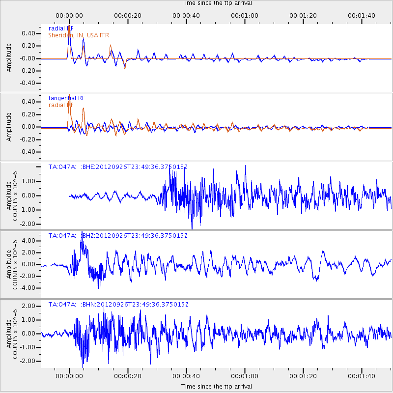
Earthquake location: Andreanof Islands, Aleutian Is.
Earthquake latitude/longitude: 51.6/-178.3
Earthquake time(UTC): 2012/09/26 (270) 23:39:55 GMT
Earthquake Depth: 16 km
Earthquake Magnitude: 6.3 MB, 6.5 MS, 6.4 MW, 6.4 MW
Earthquake Catalog/Contributor: WHDF/NEIC
Network: TA USArray Transportable Network (new EarthScope stations)
Station: O47A Sheridan, IN, USA
Lat/Lon: 40.24 N/86.17 W
Elevation: 278 m
Distance: 61.0 deg
Az: 61.031 deg
Baz: 314.526 deg
Ray Param: 0.061163988
Estimated Moho Depth: 34.0 km
Estimated Crust Vp/Vs: 1.88
Assumed Crust Vp: 6.498 km/s
Estimated Crust Vs: 3.452 km/s
Estimated Crust Poisson's Ratio: 0.30
Radial Match: 93.665344 %
Radial Bump: 303
Transverse Match: 83.20962 %
Transverse Bump: 400
SOD ConfigId: 478790
Insert Time: 2013-02-22 23:37:18.516 +0000
GWidth: 2.5
Max Bumps: 400
Tol: 0.001

Signal To Noise

ChannelStoNSTALTA
TA:O47A: :BHZ:20120926T23:49:36.375015Z14.6990831.9101935E-61.2995324E-7
TA:O47A: :BHN:20120926T23:49:36.375015Z5.05721047.2647725E-71.4365177E-7
TA:O47A: :BHE:20120926T23:49:36.375015Z4.14185246.142891E-71.4831265E-7
Arrivals
Ps4.8 SECOND
PpPs14 SECOND
PsPs/PpSs19 SECOND