P46A Rosedale, IN, USA - Earthquake Result Viewer
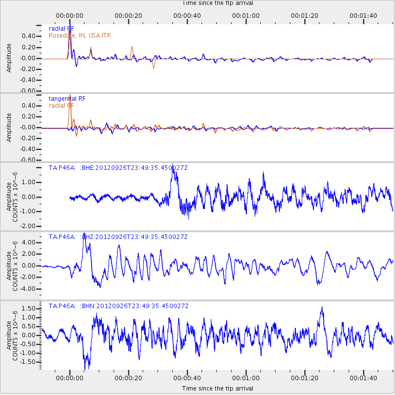
Earthquake location: Andreanof Islands, Aleutian Is.
Earthquake latitude/longitude: 51.6/-178.3
Earthquake time(UTC): 2012/09/26 (270) 23:39:55 GMT
Earthquake Depth: 16 km
Earthquake Magnitude: 6.3 MB, 6.5 MS, 6.4 MW, 6.4 MW
Earthquake Catalog/Contributor: WHDF/NEIC
Network: TA USArray Transportable Network (new EarthScope stations)
Station: P46A Rosedale, IN, USA
Lat/Lon: 39.62 N/87.21 W
Elevation: 194 m
Distance: 60.8 deg
Az: 62.171 deg
Baz: 314.421 deg
Ray Param: 0.061252527
Estimated Moho Depth: 55.0 km
Estimated Crust Vp/Vs: 1.68
Assumed Crust Vp: 6.444 km/s
Estimated Crust Vs: 3.836 km/s
Estimated Crust Poisson's Ratio: 0.23
Radial Match: 92.84118 %
Radial Bump: 338
Transverse Match: 69.06885 %
Transverse Bump: 400
SOD ConfigId: 478790
Insert Time: 2013-02-22 23:37:32.378 +0000
GWidth: 2.5
Max Bumps: 400
Tol: 0.001

Signal To Noise

ChannelStoNSTALTA
TA:P46A: :BHZ:20120926T23:49:35.450027Z12.4452861.4932848E-61.1998799E-7
TA:P46A: :BHN:20120926T23:49:35.450027Z2.0446324.051053E-71.9813118E-7
TA:P46A: :BHE:20120926T23:49:35.450027Z3.99904474.7338474E-71.1837446E-7
Arrivals
Ps6.1 SECOND
PpPs22 SECOND
PsPs/PpSs28 SECOND