
T46A Princeton, KY, USA - Earthquake Result Viewer
| ||||||||||||||||||
| ||||||||||||||||||
| ||||||||||||||||||
|
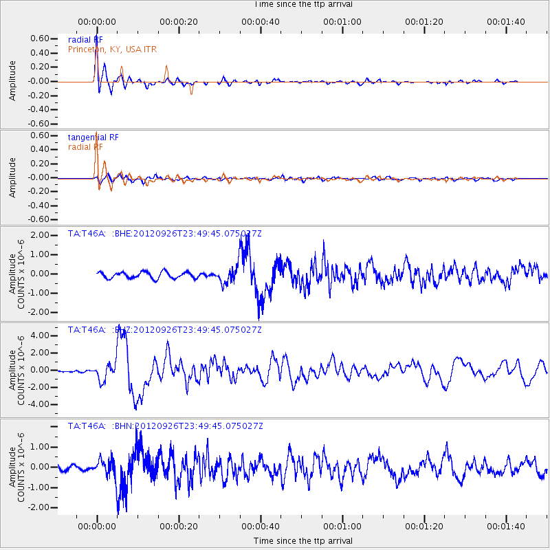
Signal To Noise
| Channel | StoN | STA | LTA |
| TA:T46A: :BHZ:20120926T23:49:45.075027Z | 10.325124 | 9.994227E-7 | 9.6795226E-8 |
| TA:T46A: :BHN:20120926T23:49:45.075027Z | 3.8780718 | 4.4750317E-7 | 1.1539321E-7 |
| TA:T46A: :BHE:20120926T23:49:45.075027Z | 2.8810356 | 4.7074752E-7 | 1.6339524E-7 |
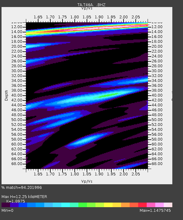
| Arrivals | |
| Ps | 1.8 SECOND |
| PpPs | 5.3 SECOND |
| PsPs/PpSs | 7.1 SECOND |

