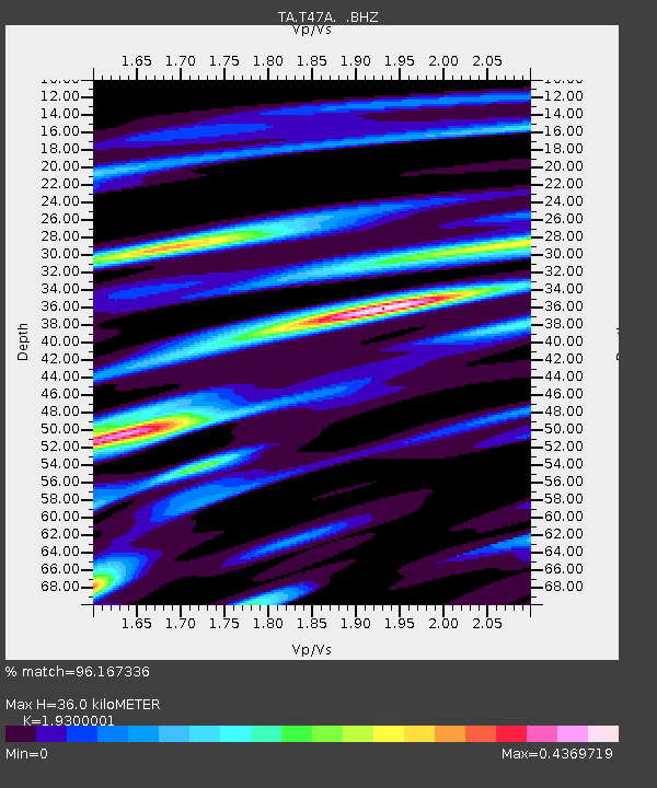
T47A Sharon Grove, KY, USA - Earthquake Result Viewer
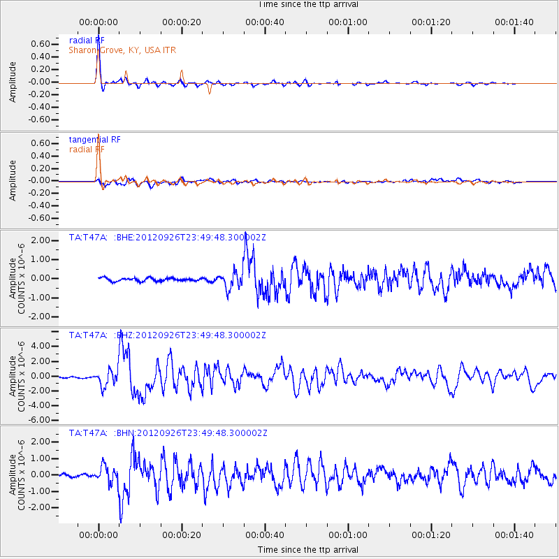
Earthquake location: Andreanof Islands, Aleutian Is.
Earthquake latitude/longitude: 51.6/-178.3
Earthquake time(UTC): 2012/09/26 (270) 23:39:55 GMT
Earthquake Depth: 16 km
Earthquake Magnitude: 6.3 MB, 6.5 MS, 6.4 MW, 6.4 MW
Earthquake Catalog/Contributor: WHDF/NEIC
Network: TA USArray Transportable Network (new EarthScope stations)
Station: T47A Sharon Grove, KY, USA
Lat/Lon: 36.99 N/87.11 W
Elevation: 217 m
Distance: 62.8 deg
Az: 64.217 deg
Baz: 315.45 deg
Ray Param: 0.0600083
Estimated Moho Depth: 36.0 km
Estimated Crust Vp/Vs: 1.93
Assumed Crust Vp: 6.444 km/s
Estimated Crust Vs: 3.339 km/s
Estimated Crust Poisson's Ratio: 0.32
Radial Match: 96.167336 %
Radial Bump: 293
Transverse Match: 78.07056 %
Transverse Bump: 400
SOD ConfigId: 478790
Insert Time: 2013-02-22 23:38:48.089 +0000
GWidth: 2.5
Max Bumps: 400
Tol: 0.001

Signal To Noise

ChannelStoNSTALTA
TA:T47A: :BHZ:20120926T23:49:48.300002Z19.7165221.1469461E-65.8171832E-8
TA:T47A: :BHN:20120926T23:49:48.300002Z6.29135565.35357E-78.5094065E-8
TA:T47A: :BHE:20120926T23:49:48.300002Z5.7875374.6331448E-78.005382E-8
Arrivals
Ps5.4 SECOND
PpPs16 SECOND
PsPs/PpSs21 SECOND