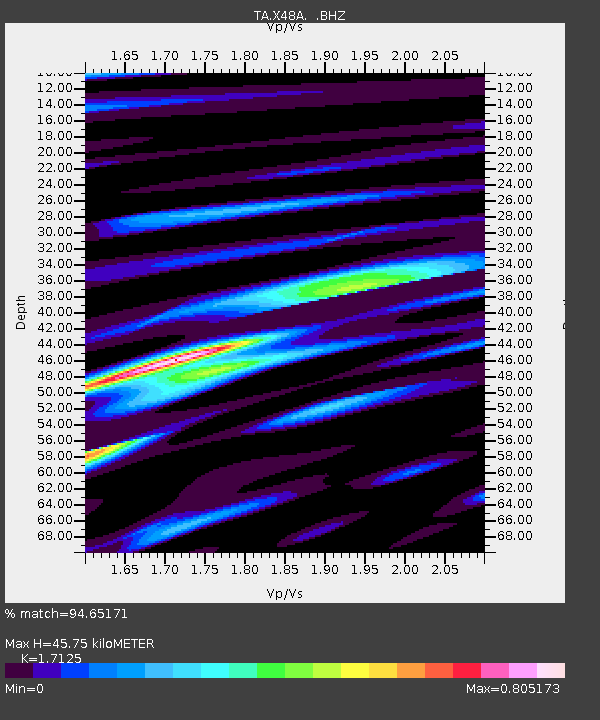
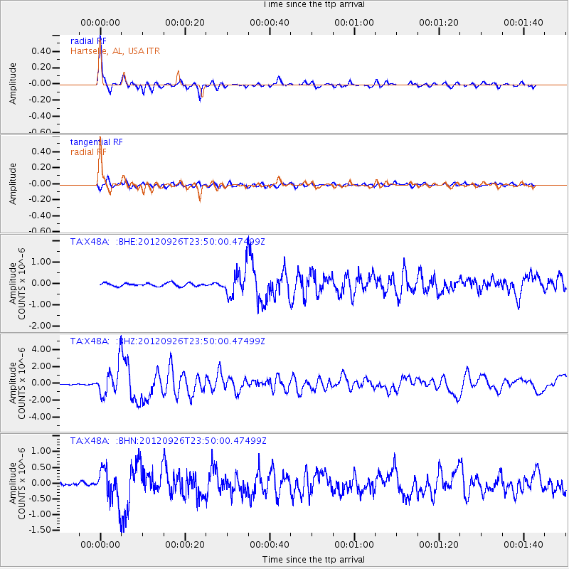
X48A Hartselle, AL, USA - Earthquake Result Viewer

Earthquake location: Andreanof Islands, Aleutian Is.
Earthquake latitude/longitude: 51.6/-178.3
Earthquake time(UTC): 2012/09/26 (270) 23:39:55 GMT
Earthquake Depth: 16 km
Earthquake Magnitude: 6.3 MB, 6.5 MS, 6.4 MW, 6.4 MW
Earthquake Catalog/Contributor: WHDF/NEIC
Network: TA USArray Transportable Network (new EarthScope stations)
Station: X48A Hartselle, AL, USA
Lat/Lon: 34.45 N/87.05 W
Elevation: 180 m
Distance: 64.6 deg
Az: 66.142 deg
Baz: 316.339 deg
Ray Param: 0.058803402
Estimated Moho Depth: 45.75 km
Estimated Crust Vp/Vs: 1.71
Assumed Crust Vp: 6.476 km/s
Estimated Crust Vs: 3.782 km/s
Estimated Crust Poisson's Ratio: 0.24
Radial Match: 94.65171 %
Radial Bump: 400
Transverse Match: 86.49593 %
Transverse Bump: 400
SOD ConfigId: 478790
Insert Time: 2013-02-22 23:40:09.522 +0000
GWidth: 2.5
Max Bumps: 400
Tol: 0.001

Signal To Noise

ChannelStoNSTALTA
TA:X48A: :BHZ:20120926T23:50:00.47499Z26.299791.8214766E-66.925822E-8
TA:X48A: :BHN:20120926T23:50:00.47499Z11.2875085.3066304E-74.7013305E-8
TA:X48A: :BHE:20120926T23:50:00.47499Z8.789696.4547316E-77.343526E-8
Arrivals
Ps5.3 SECOND
PpPs18 SECOND
PsPs/PpSs24 SECOND