Y48A Jasper, AL, USA - Earthquake Result Viewer
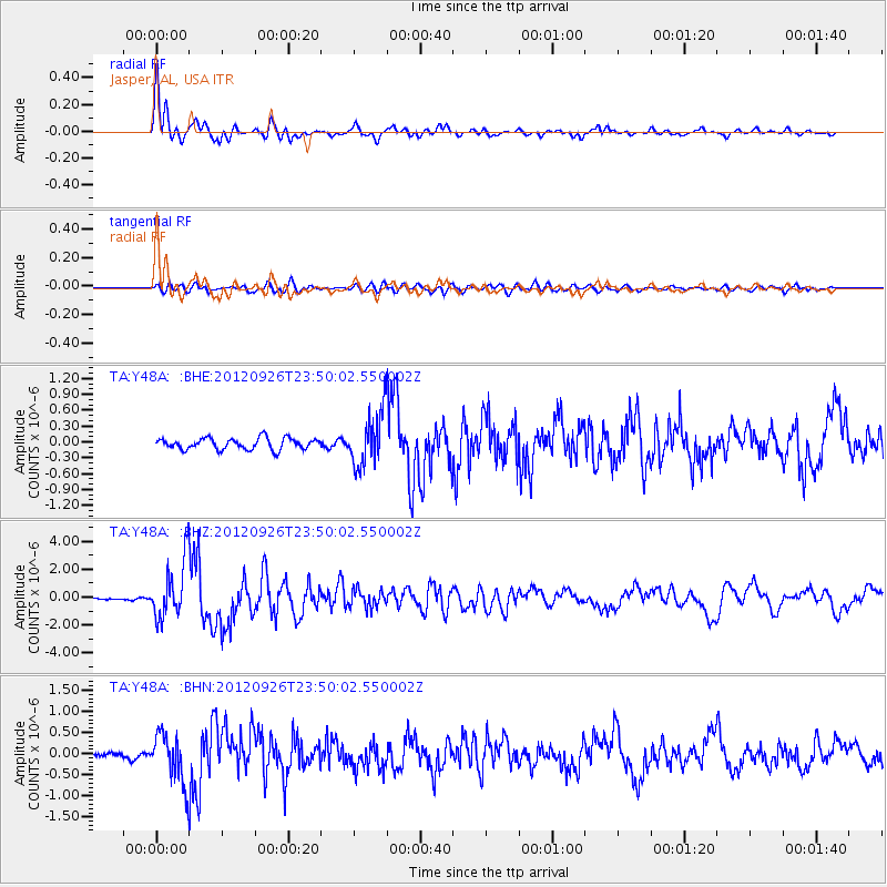
Earthquake location: Andreanof Islands, Aleutian Is.
Earthquake latitude/longitude: 51.6/-178.3
Earthquake time(UTC): 2012/09/26 (270) 23:39:55 GMT
Earthquake Depth: 16 km
Earthquake Magnitude: 6.3 MB, 6.5 MS, 6.4 MW, 6.4 MW
Earthquake Catalog/Contributor: WHDF/NEIC
Network: TA USArray Transportable Network (new EarthScope stations)
Station: Y48A Jasper, AL, USA
Lat/Lon: 33.91 N/87.17 W
Elevation: 170 m
Distance: 64.9 deg
Az: 66.635 deg
Baz: 316.479 deg
Ray Param: 0.05859821
Estimated Moho Depth: 42.25 km
Estimated Crust Vp/Vs: 1.83
Assumed Crust Vp: 6.565 km/s
Estimated Crust Vs: 3.582 km/s
Estimated Crust Poisson's Ratio: 0.29
Radial Match: 93.784805 %
Radial Bump: 365
Transverse Match: 79.62294 %
Transverse Bump: 400
SOD ConfigId: 478790
Insert Time: 2013-02-22 23:40:23.326 +0000
GWidth: 2.5
Max Bumps: 400
Tol: 0.001

Signal To Noise

ChannelStoNSTALTA
TA:Y48A: :BHZ:20120926T23:50:02.550002Z39.4523962.0211867E-65.1231027E-8
TA:Y48A: :BHN:20120926T23:50:02.550002Z10.0713395.8063904E-75.7652617E-8
TA:Y48A: :BHE:20120926T23:50:02.550002Z4.7348365.019891E-71.0602039E-7
Arrivals
Ps5.6 SECOND
PpPs17 SECOND
PsPs/PpSs23 SECOND