
Y50A Piedmont, AL, USA - Earthquake Result Viewer
| ||||||||||||||||||
| ||||||||||||||||||
| ||||||||||||||||||
|
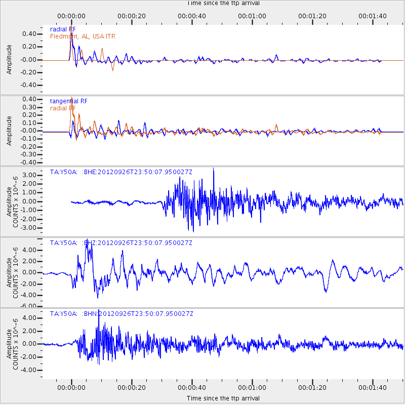
Signal To Noise
| Channel | StoN | STA | LTA |
| TA:Y50A: :BHZ:20120926T23:50:07.950027Z | 20.691904 | 1.666882E-6 | 8.05572E-8 |
| TA:Y50A: :BHN:20120926T23:50:07.950027Z | 8.671998 | 8.2124797E-7 | 9.470112E-8 |
| TA:Y50A: :BHE:20120926T23:50:07.950027Z | 6.4183016 | 7.2875764E-7 | 1.1354369E-7 |
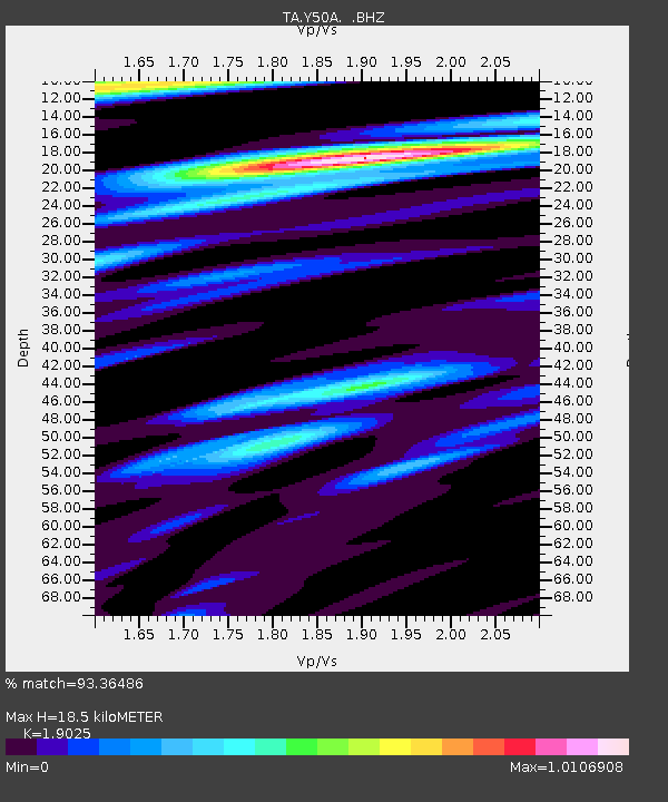
| Arrivals | |
| Ps | 2.6 SECOND |
| PpPs | 7.7 SECOND |
| PsPs/PpSs | 10 SECOND |

