
249A Camden, AL, USA - Earthquake Result Viewer
| ||||||||||||||||||
| ||||||||||||||||||
| ||||||||||||||||||
|
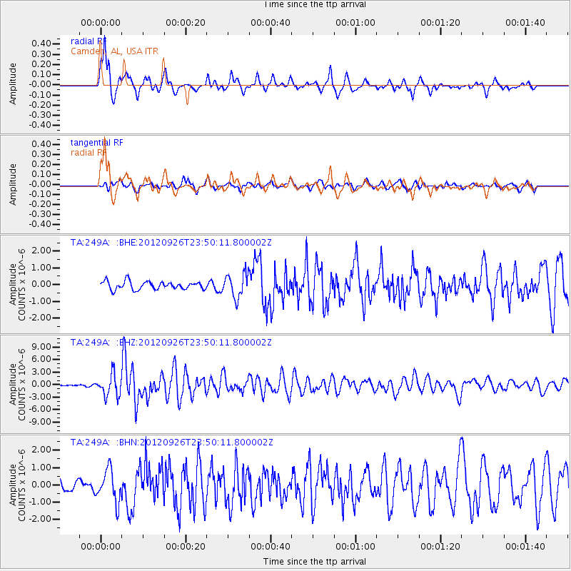
Signal To Noise
| Channel | StoN | STA | LTA |
| TA:249A: :BHZ:20120926T23:50:11.800002Z | 24.85473 | 2.5900342E-6 | 1.042069E-7 |
| TA:249A: :BHN:20120926T23:50:11.800002Z | 4.7567773 | 9.416235E-7 | 1.979541E-7 |
| TA:249A: :BHE:20120926T23:50:11.800002Z | 3.0403636 | 7.2795007E-7 | 2.3942863E-7 |
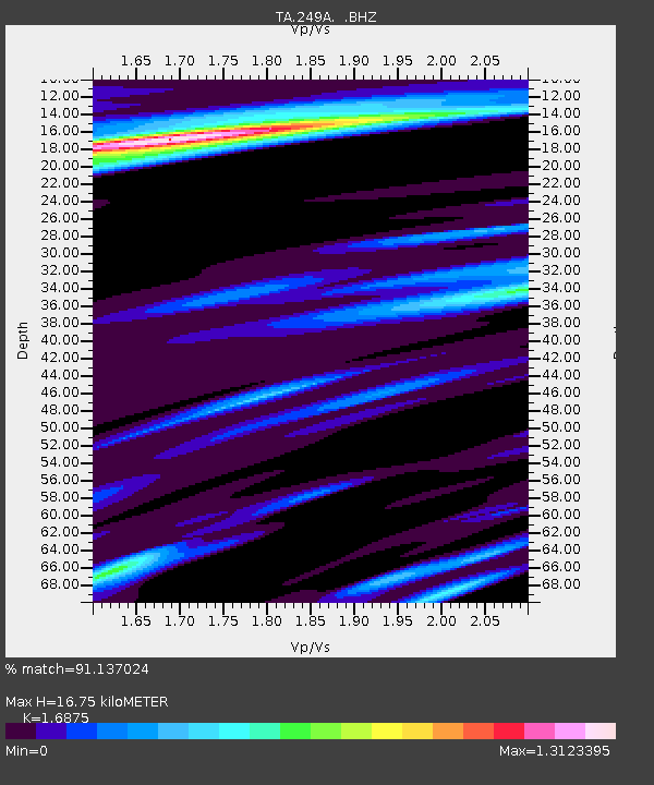
| Arrivals | |
| Ps | 1.9 SECOND |
| PpPs | 7.0 SECOND |
| PsPs/PpSs | 8.9 SECOND |

