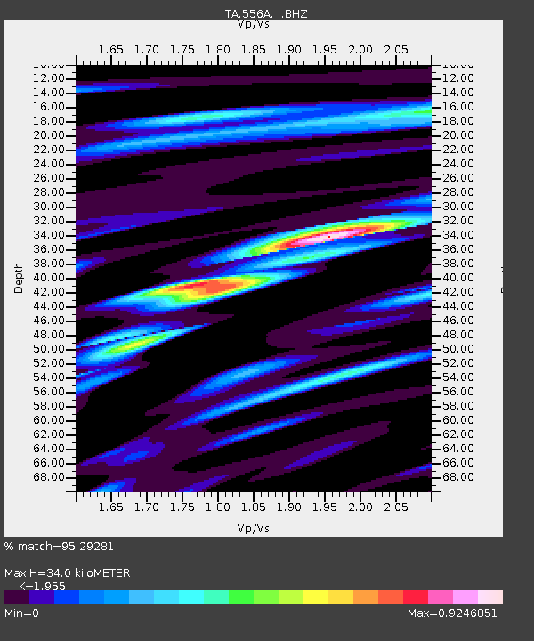
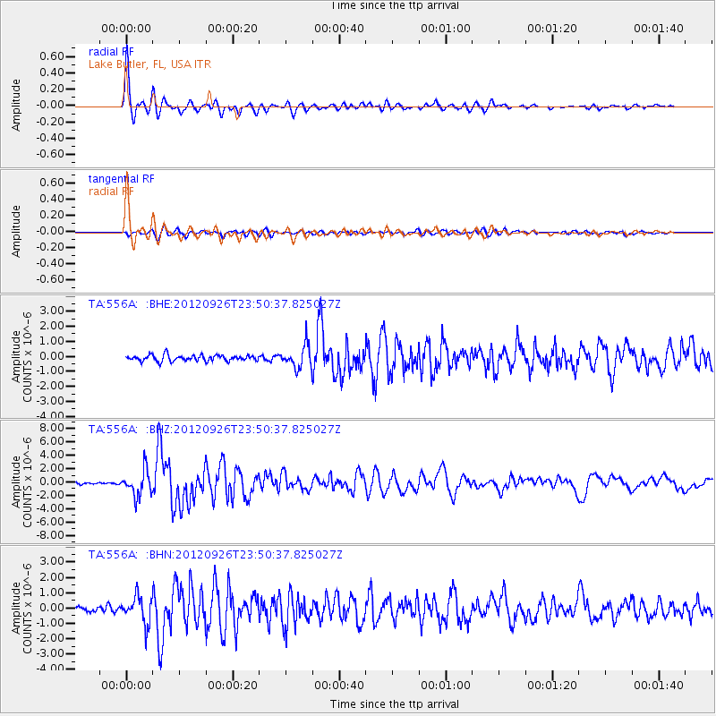
556A Lake Butler, FL, USA - Earthquake Result Viewer

Earthquake location: Andreanof Islands, Aleutian Is.
Earthquake latitude/longitude: 51.6/-178.3
Earthquake time(UTC): 2012/09/26 (270) 23:39:55 GMT
Earthquake Depth: 16 km
Earthquake Magnitude: 6.3 MB, 6.5 MS, 6.4 MW, 6.4 MW
Earthquake Catalog/Contributor: WHDF/NEIC
Network: TA USArray Transportable Network (new EarthScope stations)
Station: 556A Lake Butler, FL, USA
Lat/Lon: 30.00 N/82.41 W
Elevation: 45 m
Distance: 70.5 deg
Az: 66.237 deg
Baz: 318.84 deg
Ray Param: 0.054909833
Estimated Moho Depth: 34.0 km
Estimated Crust Vp/Vs: 1.96
Assumed Crust Vp: 6.565 km/s
Estimated Crust Vs: 3.358 km/s
Estimated Crust Poisson's Ratio: 0.32
Radial Match: 95.29281 %
Radial Bump: 366
Transverse Match: 79.05235 %
Transverse Bump: 400
SOD ConfigId: 478790
Insert Time: 2013-02-22 23:43:02.094 +0000
GWidth: 2.5
Max Bumps: 400
Tol: 0.001

Signal To Noise

ChannelStoNSTALTA
TA:556A: :BHZ:20120926T23:50:37.825027Z11.0421641.907465E-61.7274378E-7
TA:556A: :BHN:20120926T23:50:37.825027Z6.0006368.651633E-71.441786E-7
TA:556A: :BHE:20120926T23:50:37.825027Z3.80364447.4927885E-71.9698972E-7
Arrivals
Ps5.1 SECOND
PpPs15 SECOND
PsPs/PpSs20 SECOND