657A Interlachen, FL, USA - Earthquake Result Viewer
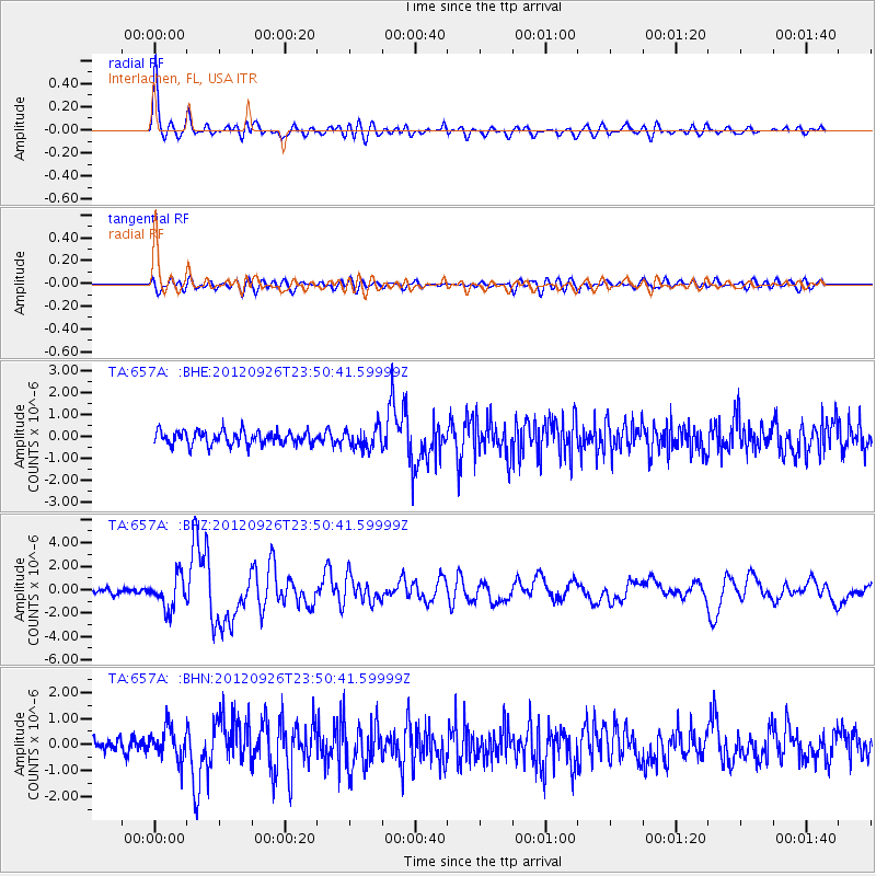
Earthquake location: Andreanof Islands, Aleutian Is.
Earthquake latitude/longitude: 51.6/-178.3
Earthquake time(UTC): 2012/09/26 (270) 23:39:55 GMT
Earthquake Depth: 16 km
Earthquake Magnitude: 6.3 MB, 6.5 MS, 6.4 MW, 6.4 MW
Earthquake Catalog/Contributor: WHDF/NEIC
Network: TA USArray Transportable Network (new EarthScope stations)
Station: 657A Interlachen, FL, USA
Lat/Lon: 29.59 N/81.87 W
Elevation: 34 m
Distance: 71.2 deg
Az: 66.151 deg
Baz: 319.079 deg
Ray Param: 0.05450029
Estimated Moho Depth: 29.25 km
Estimated Crust Vp/Vs: 2.08
Assumed Crust Vp: 6.134 km/s
Estimated Crust Vs: 2.949 km/s
Estimated Crust Poisson's Ratio: 0.35
Radial Match: 91.52663 %
Radial Bump: 400
Transverse Match: 70.74232 %
Transverse Bump: 400
SOD ConfigId: 478790
Insert Time: 2013-02-22 23:43:32.242 +0000
GWidth: 2.5
Max Bumps: 400
Tol: 0.001

Signal To Noise

ChannelStoNSTALTA
TA:657A: :BHZ:20120926T23:50:41.59999Z8.3658031.357627E-61.6228293E-7
TA:657A: :BHN:20120926T23:50:41.59999Z2.62655145.8038626E-72.2096894E-7
TA:657A: :BHE:20120926T23:50:41.59999Z1.52065344.6082647E-73.0304506E-7
Arrivals
Ps5.3 SECOND
PpPs14 SECOND
PsPs/PpSs20 SECOND