455A Stateville, GA, USA - Earthquake Result Viewer
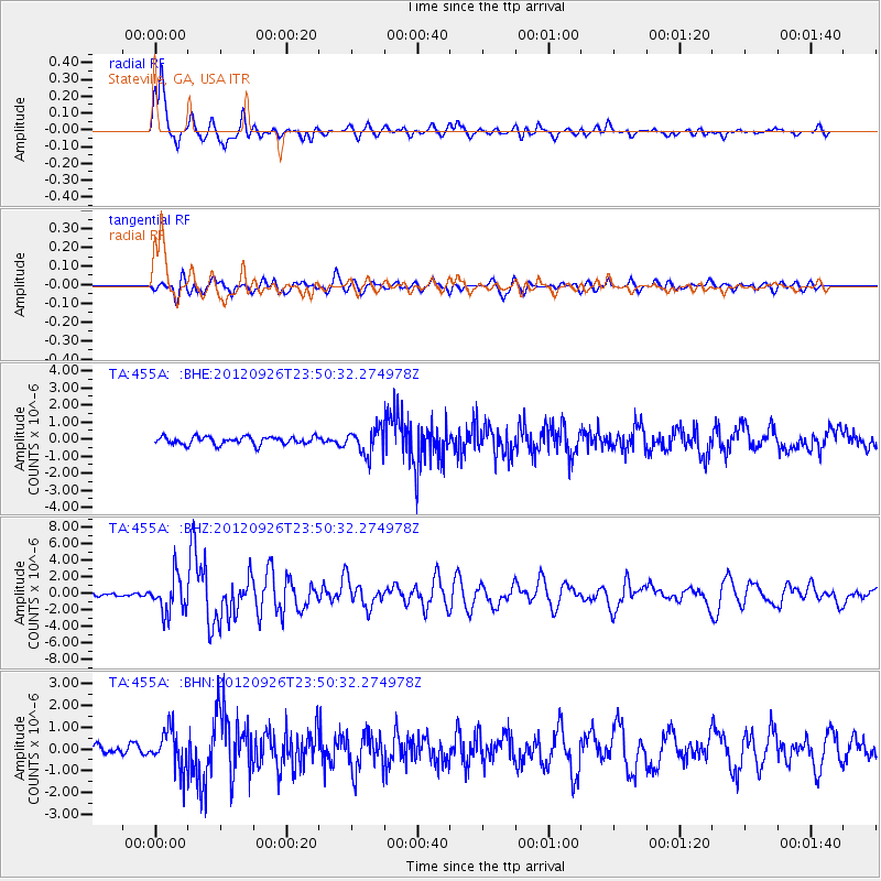
Earthquake location: Andreanof Islands, Aleutian Is.
Earthquake latitude/longitude: 51.6/-178.3
Earthquake time(UTC): 2012/09/26 (270) 23:39:55 GMT
Earthquake Depth: 16 km
Earthquake Magnitude: 6.3 MB, 6.5 MS, 6.4 MW, 6.4 MW
Earthquake Catalog/Contributor: WHDF/NEIC
Network: TA USArray Transportable Network (new EarthScope stations)
Station: 455A Stateville, GA, USA
Lat/Lon: 30.74 N/83.03 W
Elevation: 44 m
Distance: 69.6 deg
Az: 66.146 deg
Baz: 318.497 deg
Ray Param: 0.055513106
Estimated Moho Depth: 15.25 km
Estimated Crust Vp/Vs: 1.62
Assumed Crust Vp: 6.565 km/s
Estimated Crust Vs: 4.046 km/s
Estimated Crust Poisson's Ratio: 0.19
Radial Match: 92.54827 %
Radial Bump: 343
Transverse Match: 80.3048 %
Transverse Bump: 400
SOD ConfigId: 478790
Insert Time: 2013-02-22 23:43:42.935 +0000
GWidth: 2.5
Max Bumps: 400
Tol: 0.001

Signal To Noise

ChannelStoNSTALTA
TA:455A: :BHZ:20120926T23:50:32.274978Z9.7345112.1726648E-62.2319199E-7
TA:455A: :BHN:20120926T23:50:32.274978Z4.88106638.8776363E-71.8187903E-7
TA:455A: :BHE:20120926T23:50:32.274978Z3.29043087.476427E-72.2721726E-7
Arrivals
Ps1.5 SECOND
PpPs5.8 SECOND
PsPs/PpSs7.3 SECOND