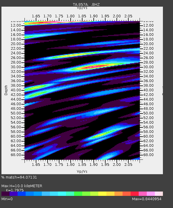
857A Zephyrhills, FL, USA - Earthquake Result Viewer

Earthquake location: Andreanof Islands, Aleutian Is.
Earthquake latitude/longitude: 51.6/-178.3
Earthquake time(UTC): 2012/09/26 (270) 23:39:55 GMT
Earthquake Depth: 16 km
Earthquake Magnitude: 6.3 MB, 6.5 MS, 6.4 MW, 6.4 MW
Earthquake Catalog/Contributor: WHDF/NEIC
Network: TA USArray Transportable Network (new EarthScope stations)
Station: 857A Zephyrhills, FL, USA
Lat/Lon: 28.27 N/82.23 W
Elevation: 50 m
Distance: 71.9 deg
Az: 67.31 deg
Baz: 319.271 deg
Ray Param: 0.053982858
Estimated Moho Depth: 10.0 km
Estimated Crust Vp/Vs: 1.80
Assumed Crust Vp: 5.989 km/s
Estimated Crust Vs: 3.332 km/s
Estimated Crust Poisson's Ratio: 0.28
Radial Match: 94.07131 %
Radial Bump: 400
Transverse Match: 78.31356 %
Transverse Bump: 400
SOD ConfigId: 478790
Insert Time: 2013-02-22 23:44:41.581 +0000
GWidth: 2.5
Max Bumps: 400
Tol: 0.001

Signal To Noise

ChannelStoNSTALTA
TA:857A: :BHZ:20120926T23:50:46.325027Z14.1803142.5958257E-61.830584E-7
TA:857A: :BHN:20120926T23:50:46.325027Z3.23243215.909164E-71.828086E-7
TA:857A: :BHE:20120926T23:50:46.325027Z2.85722647.3441225E-72.570368E-7
Arrivals
Ps1.4 SECOND
PpPs4.5 SECOND
PsPs/PpSs5.9 SECOND