958A Wauchula, FL, USA - Earthquake Result Viewer
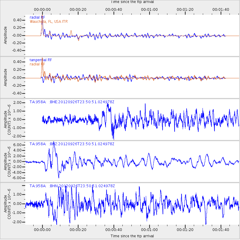
Earthquake location: Andreanof Islands, Aleutian Is.
Earthquake latitude/longitude: 51.6/-178.3
Earthquake time(UTC): 2012/09/26 (270) 23:39:55 GMT
Earthquake Depth: 16 km
Earthquake Magnitude: 6.3 MB, 6.5 MS, 6.4 MW, 6.4 MW
Earthquake Catalog/Contributor: WHDF/NEIC
Network: TA USArray Transportable Network (new EarthScope stations)
Station: 958A Wauchula, FL, USA
Lat/Lon: 27.59 N/81.75 W
Elevation: 30 m
Distance: 72.7 deg
Az: 67.438 deg
Baz: 319.531 deg
Ray Param: 0.053459797
Estimated Moho Depth: 10.0 km
Estimated Crust Vp/Vs: 1.74
Assumed Crust Vp: 6.347 km/s
Estimated Crust Vs: 3.658 km/s
Estimated Crust Poisson's Ratio: 0.25
Radial Match: 92.25888 %
Radial Bump: 400
Transverse Match: 79.18764 %
Transverse Bump: 400
SOD ConfigId: 478790
Insert Time: 2013-02-22 23:44:55.479 +0000
GWidth: 2.5
Max Bumps: 400
Tol: 0.001

Signal To Noise

ChannelStoNSTALTA
TA:958A: :BHZ:20120926T23:50:51.024978Z9.7256982.020478E-62.0774633E-7
TA:958A: :BHN:20120926T23:50:51.024978Z2.7179795.533934E-72.0360476E-7
TA:958A: :BHE:20120926T23:50:51.024978Z2.5566726.121927E-72.3944907E-7
Arrivals
Ps1.2 SECOND
PpPs4.2 SECOND
PsPs/PpSs5.4 SECOND