352A Blakely, GA, USA - Earthquake Result Viewer
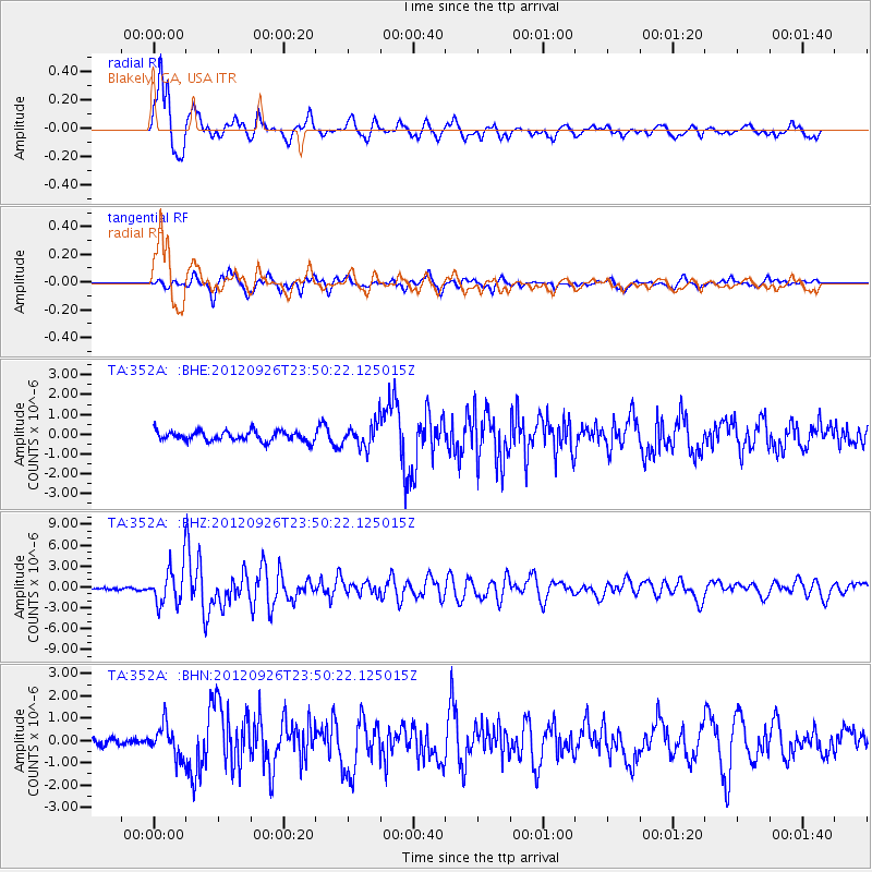
Earthquake location: Andreanof Islands, Aleutian Is.
Earthquake latitude/longitude: 51.6/-178.3
Earthquake time(UTC): 2012/09/26 (270) 23:39:55 GMT
Earthquake Depth: 16 km
Earthquake Magnitude: 6.3 MB, 6.5 MS, 6.4 MW, 6.4 MW
Earthquake Catalog/Contributor: WHDF/NEIC
Network: TA USArray Transportable Network (new EarthScope stations)
Station: 352A Blakely, GA, USA
Lat/Lon: 31.48 N/84.93 W
Elevation: 101 m
Distance: 68.0 deg
Az: 66.923 deg
Baz: 317.801 deg
Ray Param: 0.056586716
Estimated Moho Depth: 16.5 km
Estimated Crust Vp/Vs: 1.82
Assumed Crust Vp: 6.347 km/s
Estimated Crust Vs: 3.497 km/s
Estimated Crust Poisson's Ratio: 0.28
Radial Match: 90.55323 %
Radial Bump: 400
Transverse Match: 76.941376 %
Transverse Bump: 400
SOD ConfigId: 478790
Insert Time: 2013-02-22 23:44:57.011 +0000
GWidth: 2.5
Max Bumps: 400
Tol: 0.001

Signal To Noise

ChannelStoNSTALTA
TA:352A: :BHZ:20120926T23:50:22.125015Z17.4570852.6858502E-61.5385444E-7
TA:352A: :BHN:20120926T23:50:22.125015Z3.8325417.151535E-71.8660036E-7
TA:352A: :BHE:20120926T23:50:22.125015Z2.40466366.025972E-72.505952E-7
Arrivals
Ps2.2 SECOND
PpPs7.1 SECOND
PsPs/PpSs9.3 SECOND