058A Arcadia, FL, USA - Earthquake Result Viewer
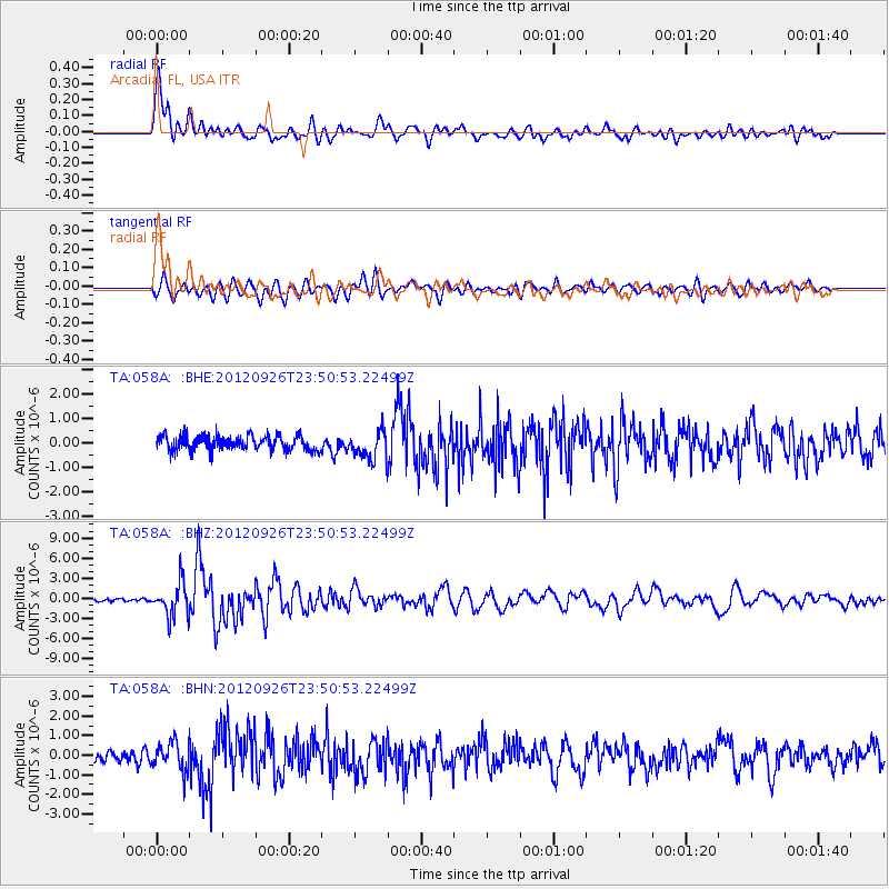
Earthquake location: Andreanof Islands, Aleutian Is.
Earthquake latitude/longitude: 51.6/-178.3
Earthquake time(UTC): 2012/09/26 (270) 23:39:55 GMT
Earthquake Depth: 16 km
Earthquake Magnitude: 6.3 MB, 6.5 MS, 6.4 MW, 6.4 MW
Earthquake Catalog/Contributor: WHDF/NEIC
Network: TA USArray Transportable Network (new EarthScope stations)
Station: 058A Arcadia, FL, USA
Lat/Lon: 27.06 N/81.80 W
Elevation: 15 m
Distance: 73.1 deg
Az: 67.831 deg
Baz: 319.624 deg
Ray Param: 0.053216312
Estimated Moho Depth: 38.75 km
Estimated Crust Vp/Vs: 1.81
Assumed Crust Vp: 6.347 km/s
Estimated Crust Vs: 3.512 km/s
Estimated Crust Poisson's Ratio: 0.28
Radial Match: 90.97499 %
Radial Bump: 400
Transverse Match: 80.023415 %
Transverse Bump: 400
SOD ConfigId: 478790
Insert Time: 2013-02-22 23:45:24.562 +0000
GWidth: 2.5
Max Bumps: 400
Tol: 0.001

Signal To Noise

ChannelStoNSTALTA
TA:058A: :BHZ:20120926T23:50:53.22499Z14.4709582.4873364E-61.7188471E-7
TA:058A: :BHN:20120926T23:50:53.22499Z2.75109397.267788E-72.641781E-7
TA:058A: :BHE:20120926T23:50:53.22499Z1.93960195.815952E-72.9985287E-7
Arrivals
Ps5.1 SECOND
PpPs17 SECOND
PsPs/PpSs22 SECOND