252A Lumpkin, GA, USA - Earthquake Result Viewer
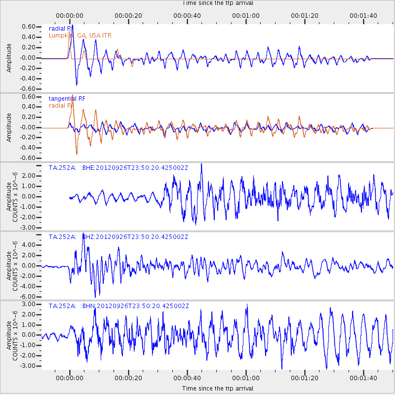
Earthquake location: Andreanof Islands, Aleutian Is.
Earthquake latitude/longitude: 51.6/-178.3
Earthquake time(UTC): 2012/09/26 (270) 23:39:55 GMT
Earthquake Depth: 16 km
Earthquake Magnitude: 6.3 MB, 6.5 MS, 6.4 MW, 6.4 MW
Earthquake Catalog/Contributor: WHDF/NEIC
Network: TA USArray Transportable Network (new EarthScope stations)
Station: 252A Lumpkin, GA, USA
Lat/Lon: 32.00 N/84.74 W
Elevation: 142 m
Distance: 67.7 deg
Az: 66.419 deg
Baz: 317.711 deg
Ray Param: 0.056763772
Estimated Moho Depth: 14.5 km
Estimated Crust Vp/Vs: 1.62
Assumed Crust Vp: 6.347 km/s
Estimated Crust Vs: 3.93 km/s
Estimated Crust Poisson's Ratio: 0.19
Radial Match: 91.020164 %
Radial Bump: 388
Transverse Match: 70.31176 %
Transverse Bump: 400
SOD ConfigId: 478790
Insert Time: 2013-02-22 23:45:36.579 +0000
GWidth: 2.5
Max Bumps: 400
Tol: 0.001

Signal To Noise

ChannelStoNSTALTA
TA:252A: :BHZ:20120926T23:50:20.425002Z18.7784612.353587E-61.253344E-7
TA:252A: :BHN:20120926T23:50:20.425002Z3.06008936.967448E-72.2768772E-7
TA:252A: :BHE:20120926T23:50:20.425002Z2.36445746.6568543E-72.8153838E-7
Arrivals
Ps1.5 SECOND
PpPs5.7 SECOND
PsPs/PpSs7.2 SECOND