355A Pearson, GA, USA - Earthquake Result Viewer
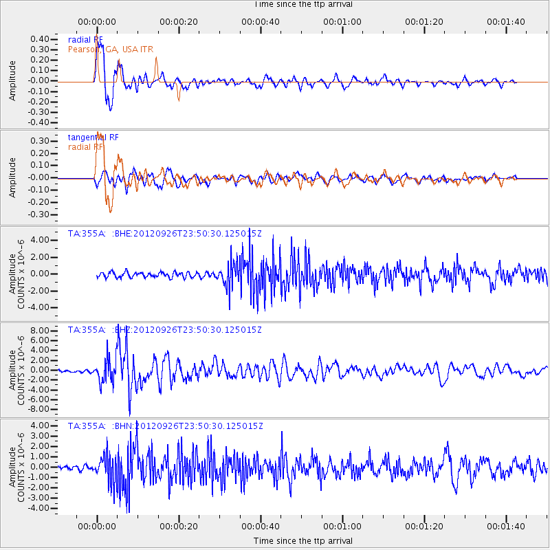
Earthquake location: Andreanof Islands, Aleutian Is.
Earthquake latitude/longitude: 51.6/-178.3
Earthquake time(UTC): 2012/09/26 (270) 23:39:55 GMT
Earthquake Depth: 16 km
Earthquake Magnitude: 6.3 MB, 6.5 MS, 6.4 MW, 6.4 MW
Earthquake Catalog/Contributor: WHDF/NEIC
Network: TA USArray Transportable Network (new EarthScope stations)
Station: 355A Pearson, GA, USA
Lat/Lon: 31.34 N/82.85 W
Elevation: 69 m
Distance: 69.3 deg
Az: 65.602 deg
Baz: 318.396 deg
Ray Param: 0.055745196
Estimated Moho Depth: 15.75 km
Estimated Crust Vp/Vs: 1.61
Assumed Crust Vp: 6.565 km/s
Estimated Crust Vs: 4.09 km/s
Estimated Crust Poisson's Ratio: 0.18
Radial Match: 94.82374 %
Radial Bump: 400
Transverse Match: 75.780716 %
Transverse Bump: 400
SOD ConfigId: 478790
Insert Time: 2013-02-22 23:45:52.793 +0000
GWidth: 2.5
Max Bumps: 400
Tol: 0.001

Signal To Noise

ChannelStoNSTALTA
TA:355A: :BHZ:20120926T23:50:30.125015Z12.7345262.425716E-61.9048342E-7
TA:355A: :BHN:20120926T23:50:30.125015Z6.1992791.2708882E-62.0500582E-7
TA:355A: :BHE:20120926T23:50:30.125015Z4.546281.3697482E-63.012899E-7
Arrivals
Ps1.5 SECOND
PpPs6.0 SECOND
PsPs/PpSs7.5 SECOND