156A Sylvania, GA, USA - Earthquake Result Viewer
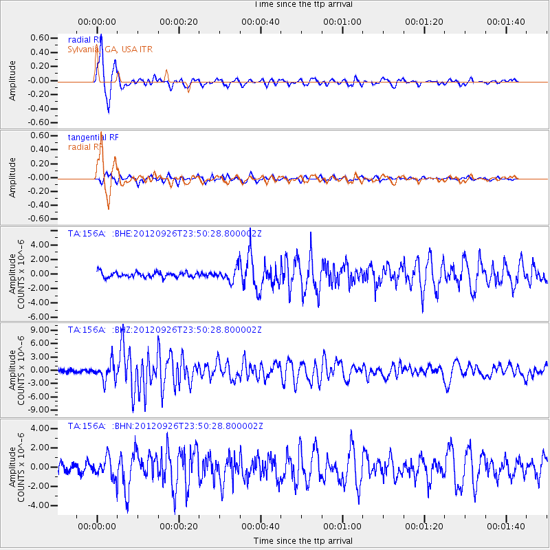
Earthquake location: Andreanof Islands, Aleutian Is.
Earthquake latitude/longitude: 51.6/-178.3
Earthquake time(UTC): 2012/09/26 (270) 23:39:55 GMT
Earthquake Depth: 16 km
Earthquake Magnitude: 6.3 MB, 6.5 MS, 6.4 MW, 6.4 MW
Earthquake Catalog/Contributor: WHDF/NEIC
Network: TA USArray Transportable Network (new EarthScope stations)
Station: 156A Sylvania, GA, USA
Lat/Lon: 32.65 N/81.50 W
Elevation: 40 m
Distance: 69.1 deg
Az: 63.751 deg
Baz: 318.453 deg
Ray Param: 0.055884875
Estimated Moho Depth: 13.75 km
Estimated Crust Vp/Vs: 1.60
Assumed Crust Vp: 6.565 km/s
Estimated Crust Vs: 4.103 km/s
Estimated Crust Poisson's Ratio: 0.18
Radial Match: 94.91 %
Radial Bump: 346
Transverse Match: 76.54795 %
Transverse Bump: 391
SOD ConfigId: 478790
Insert Time: 2013-02-22 23:47:09.837 +0000
GWidth: 2.5
Max Bumps: 400
Tol: 0.001

Signal To Noise

ChannelStoNSTALTA
TA:156A: :BHZ:20120926T23:50:28.800002Z6.05649662.105562E-63.4765347E-7
TA:156A: :BHN:20120926T23:50:28.800002Z2.21052891.0520034E-64.759058E-7
TA:156A: :BHE:20120926T23:50:28.800002Z2.78263889.708074E-73.4888012E-7
Arrivals
Ps1.3 SECOND
PpPs5.2 SECOND
PsPs/PpSs6.5 SECOND