X51A Calhoun, GA, USA - Earthquake Result Viewer
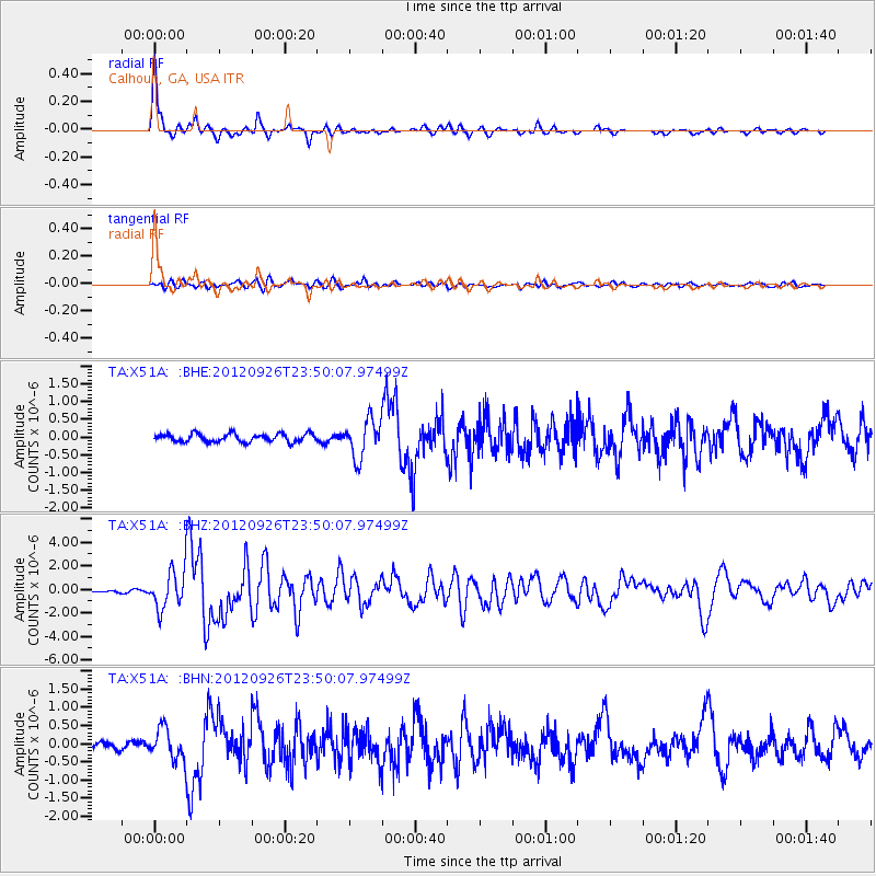
Earthquake location: Andreanof Islands, Aleutian Is.
Earthquake latitude/longitude: 51.6/-178.3
Earthquake time(UTC): 2012/09/26 (270) 23:39:55 GMT
Earthquake Depth: 16 km
Earthquake Magnitude: 6.3 MB, 6.5 MS, 6.4 MW, 6.4 MW
Earthquake Catalog/Contributor: WHDF/NEIC
Network: TA USArray Transportable Network (new EarthScope stations)
Station: X51A Calhoun, GA, USA
Lat/Lon: 34.57 N/84.86 W
Elevation: 214 m
Distance: 65.8 deg
Az: 64.609 deg
Baz: 316.93 deg
Ray Param: 0.058046747
Estimated Moho Depth: 44.0 km
Estimated Crust Vp/Vs: 1.76
Assumed Crust Vp: 6.35 km/s
Estimated Crust Vs: 3.613 km/s
Estimated Crust Poisson's Ratio: 0.26
Radial Match: 93.93408 %
Radial Bump: 315
Transverse Match: 73.88061 %
Transverse Bump: 400
SOD ConfigId: 478790
Insert Time: 2013-02-22 23:47:13.646 +0000
GWidth: 2.5
Max Bumps: 400
Tol: 0.001

Signal To Noise

ChannelStoNSTALTA
TA:X51A: :BHZ:20120926T23:50:07.97499Z19.9257771.6071704E-68.065785E-8
TA:X51A: :BHN:20120926T23:50:07.97499Z4.9629514.304922E-78.6741174E-8
TA:X51A: :BHE:20120926T23:50:07.97499Z4.54820165.30231E-71.1658036E-7
Arrivals
Ps5.5 SECOND
PpPs18 SECOND
PsPs/PpSs24 SECOND