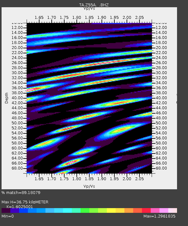
Z55A Blythe, GA, USA - Earthquake Result Viewer
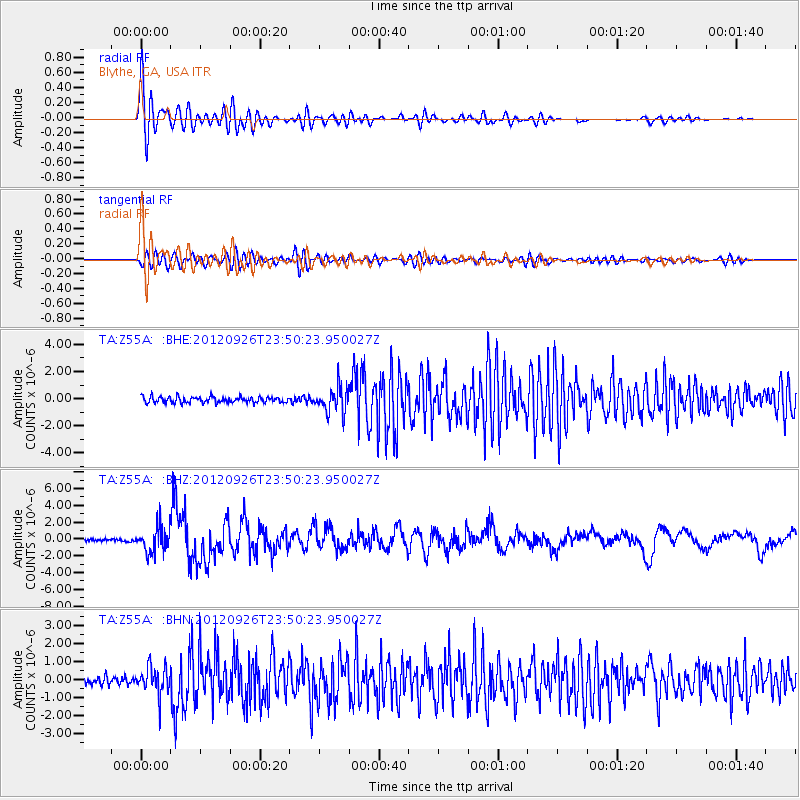
Earthquake location: Andreanof Islands, Aleutian Is.
Earthquake latitude/longitude: 51.6/-178.3
Earthquake time(UTC): 2012/09/26 (270) 23:39:55 GMT
Earthquake Depth: 16 km
Earthquake Magnitude: 6.3 MB, 6.5 MS, 6.4 MW, 6.4 MW
Earthquake Catalog/Contributor: WHDF/NEIC
Network: TA USArray Transportable Network (new EarthScope stations)
Station: Z55A Blythe, GA, USA
Lat/Lon: 33.22 N/82.14 W
Elevation: 100 m
Distance: 68.3 deg
Az: 63.779 deg
Baz: 318.116 deg
Ray Param: 0.05639547
Estimated Moho Depth: 36.75 km
Estimated Crust Vp/Vs: 1.60
Assumed Crust Vp: 6.565 km/s
Estimated Crust Vs: 4.096 km/s
Estimated Crust Poisson's Ratio: 0.18
Radial Match: 89.18079 %
Radial Bump: 400
Transverse Match: 75.324394 %
Transverse Bump: 400
SOD ConfigId: 478790
Insert Time: 2013-02-22 23:47:22.942 +0000
GWidth: 2.5
Max Bumps: 400
Tol: 0.001

Signal To Noise

ChannelStoNSTALTA
TA:Z55A: :BHZ:20120926T23:50:23.950027Z9.0834811.524761E-61.6786089E-7
TA:Z55A: :BHN:20120926T23:50:23.950027Z3.78176557.494751E-71.9818127E-7
TA:Z55A: :BHE:20120926T23:50:23.950027Z4.2754559.191776E-72.1498941E-7
Arrivals
Ps3.5 SECOND
PpPs14 SECOND
PsPs/PpSs17 SECOND