Y51A Rockmart, GA, USA - Earthquake Result Viewer
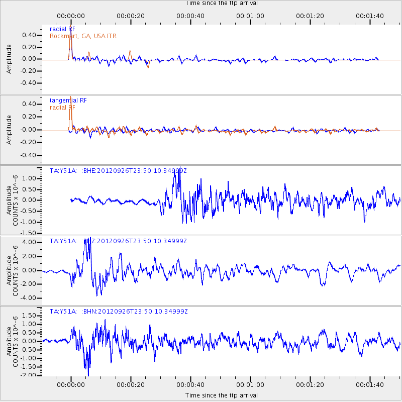
Earthquake location: Andreanof Islands, Aleutian Is.
Earthquake latitude/longitude: 51.6/-178.3
Earthquake time(UTC): 2012/09/26 (270) 23:39:55 GMT
Earthquake Depth: 16 km
Earthquake Magnitude: 6.3 MB, 6.5 MS, 6.4 MW, 6.4 MW
Earthquake Catalog/Contributor: WHDF/NEIC
Network: TA USArray Transportable Network (new EarthScope stations)
Station: Y51A Rockmart, GA, USA
Lat/Lon: 33.90 N/85.06 W
Elevation: 380 m
Distance: 66.1 deg
Az: 65.243 deg
Baz: 317.072 deg
Ray Param: 0.057804663
Estimated Moho Depth: 44.0 km
Estimated Crust Vp/Vs: 1.60
Assumed Crust Vp: 6.719 km/s
Estimated Crust Vs: 4.2 km/s
Estimated Crust Poisson's Ratio: 0.18
Radial Match: 89.51433 %
Radial Bump: 317
Transverse Match: 78.202225 %
Transverse Bump: 400
SOD ConfigId: 478790
Insert Time: 2013-02-22 23:47:34.937 +0000
GWidth: 2.5
Max Bumps: 400
Tol: 0.001

Signal To Noise

ChannelStoNSTALTA
TA:Y51A: :BHZ:20120926T23:50:10.34999Z17.4583261.6387323E-69.3865374E-8
TA:Y51A: :BHN:20120926T23:50:10.34999Z4.88398935.289111E-71.08294884E-7
TA:Y51A: :BHE:20120926T23:50:10.34999Z5.94036874.768041E-78.0265075E-8
Arrivals
Ps4.1 SECOND
PpPs16 SECOND
PsPs/PpSs20 SECOND