
Y52A Lilburn, GA, USA - Earthquake Result Viewer
| ||||||||||||||||||
| ||||||||||||||||||
| ||||||||||||||||||
|
Signal To Noise
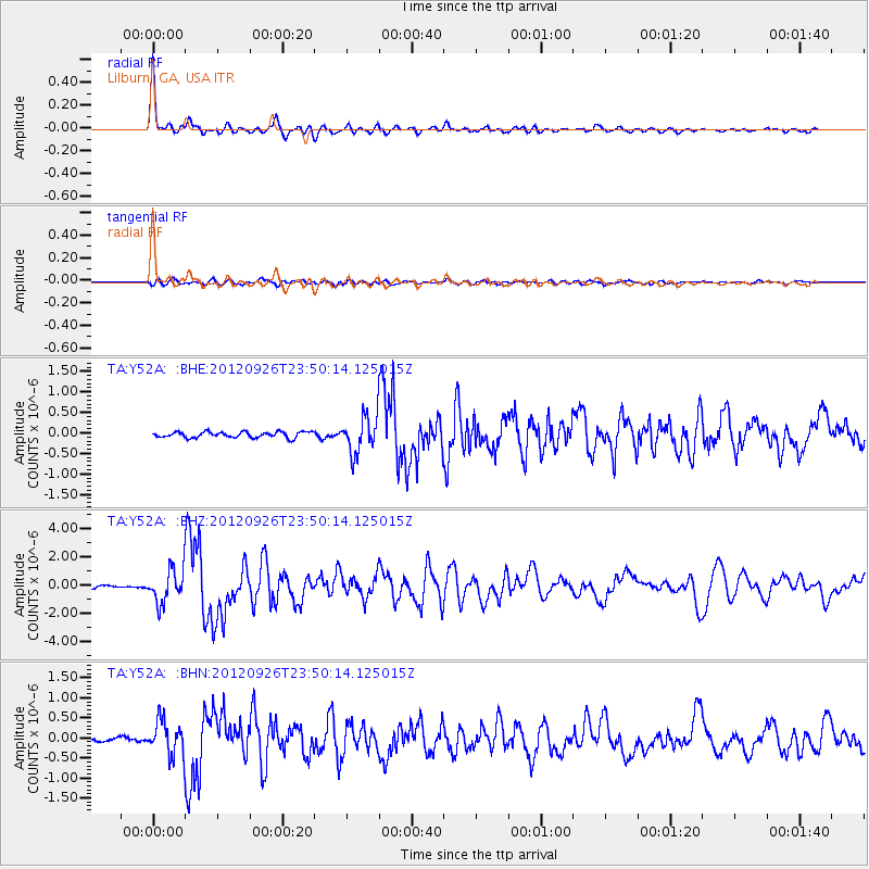
| Channel | StoN | STA | LTA |
| TA:Y52A: :BHZ:20120926T23:50:14.125015Z | 8.238714 | 1.1745577E-6 | 1.4256565E-7 |
| TA:Y52A: :BHN:20120926T23:50:14.125015Z | 7.1015916 | 4.251681E-7 | 5.9869414E-8 |
| TA:Y52A: :BHE:20120926T23:50:14.125015Z | 6.324955 | 4.467355E-7 | 7.063063E-8 |
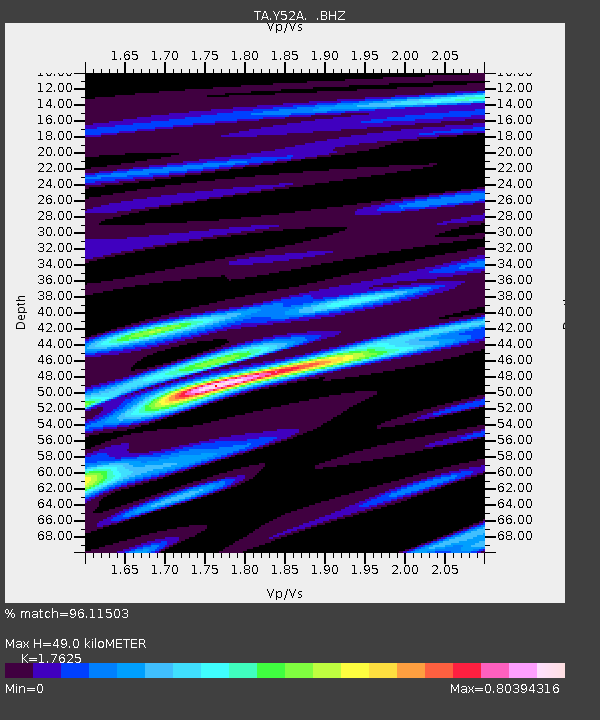
| Arrivals | |
| Ps | 5.8 SECOND |
| PpPs | 19 SECOND |
| PsPs/PpSs | 25 SECOND |

