W50A Signal Mountain, TN, USA - Earthquake Result Viewer
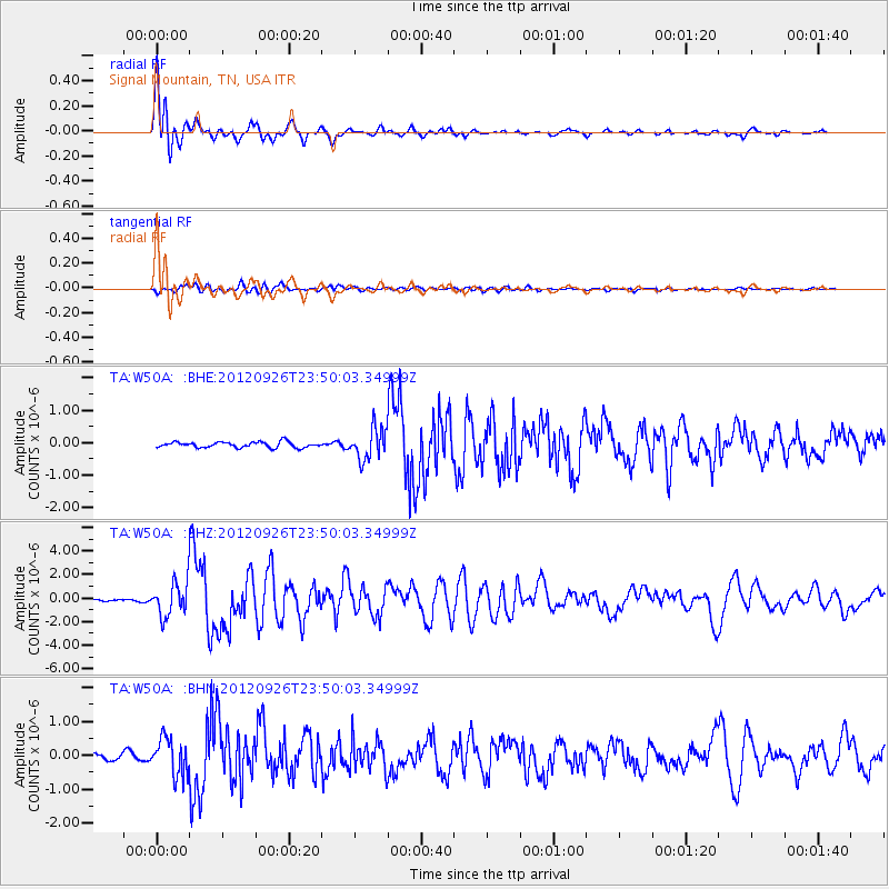
Earthquake location: Andreanof Islands, Aleutian Is.
Earthquake latitude/longitude: 51.6/-178.3
Earthquake time(UTC): 2012/09/26 (270) 23:39:55 GMT
Earthquake Depth: 16 km
Earthquake Magnitude: 6.3 MB, 6.5 MS, 6.4 MW, 6.4 MW
Earthquake Catalog/Contributor: WHDF/NEIC
Network: TA USArray Transportable Network (new EarthScope stations)
Station: W50A Signal Mountain, TN, USA
Lat/Lon: 35.20 N/85.31 W
Elevation: 587 m
Distance: 65.0 deg
Az: 64.432 deg
Baz: 316.597 deg
Ray Param: 0.058517564
Estimated Moho Depth: 49.75 km
Estimated Crust Vp/Vs: 1.74
Assumed Crust Vp: 6.35 km/s
Estimated Crust Vs: 3.649 km/s
Estimated Crust Poisson's Ratio: 0.25
Radial Match: 95.406624 %
Radial Bump: 400
Transverse Match: 82.4937 %
Transverse Bump: 400
SOD ConfigId: 478790
Insert Time: 2013-02-22 23:48:25.675 +0000
GWidth: 2.5
Max Bumps: 400
Tol: 0.001

Signal To Noise

ChannelStoNSTALTA
TA:W50A: :BHZ:20120926T23:50:03.34999Z18.3667871.3947864E-67.594068E-8
TA:W50A: :BHN:20120926T23:50:03.34999Z7.44228555.390985E-77.2437224E-8
TA:W50A: :BHE:20120926T23:50:03.34999Z5.4666044.725085E-78.643547E-8
Arrivals
Ps6.0 SECOND
PpPs21 SECOND
PsPs/PpSs27 SECOND