W49A Belvidere, TN, USA - Earthquake Result Viewer
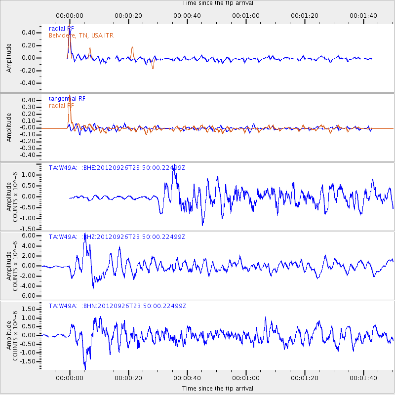
Earthquake location: Andreanof Islands, Aleutian Is.
Earthquake latitude/longitude: 51.6/-178.3
Earthquake time(UTC): 2012/09/26 (270) 23:39:55 GMT
Earthquake Depth: 16 km
Earthquake Magnitude: 6.3 MB, 6.5 MS, 6.4 MW, 6.4 MW
Earthquake Catalog/Contributor: WHDF/NEIC
Network: TA USArray Transportable Network (new EarthScope stations)
Station: W49A Belvidere, TN, USA
Lat/Lon: 35.12 N/86.26 W
Elevation: 251 m
Distance: 64.6 deg
Az: 65.119 deg
Baz: 316.343 deg
Ray Param: 0.05882791
Estimated Moho Depth: 23.0 km
Estimated Crust Vp/Vs: 1.81
Assumed Crust Vp: 6.476 km/s
Estimated Crust Vs: 3.583 km/s
Estimated Crust Poisson's Ratio: 0.28
Radial Match: 93.5748 %
Radial Bump: 400
Transverse Match: 80.84285 %
Transverse Bump: 400
SOD ConfigId: 478790
Insert Time: 2013-02-22 23:48:26.515 +0000
GWidth: 2.5
Max Bumps: 400
Tol: 0.001

Signal To Noise

ChannelStoNSTALTA
TA:W49A: :BHZ:20120926T23:50:00.22499Z15.5855031.5034547E-69.6464944E-8
TA:W49A: :BHN:20120926T23:50:00.22499Z8.852024.6535405E-75.2570375E-8
TA:W49A: :BHE:20120926T23:50:00.22499Z7.540874.304915E-75.7087775E-8
Arrivals
Ps3.0 SECOND
PpPs9.6 SECOND
PsPs/PpSs13 SECOND