T50A Nancy, KY, USA - Earthquake Result Viewer
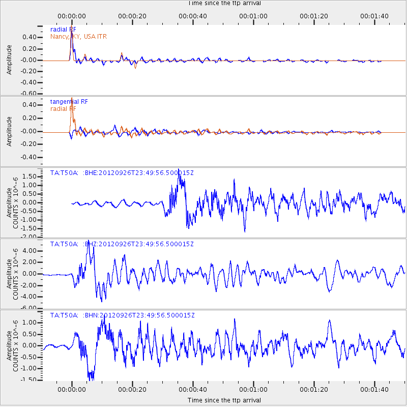
Earthquake location: Andreanof Islands, Aleutian Is.
Earthquake latitude/longitude: 51.6/-178.3
Earthquake time(UTC): 2012/09/26 (270) 23:39:55 GMT
Earthquake Depth: 16 km
Earthquake Magnitude: 6.3 MB, 6.5 MS, 6.4 MW, 6.4 MW
Earthquake Catalog/Contributor: WHDF/NEIC
Network: TA USArray Transportable Network (new EarthScope stations)
Station: T50A Nancy, KY, USA
Lat/Lon: 37.02 N/84.84 W
Elevation: 302 m
Distance: 64.0 deg
Az: 62.736 deg
Baz: 316.145 deg
Ray Param: 0.059199102
Estimated Moho Depth: 43.0 km
Estimated Crust Vp/Vs: 1.60
Assumed Crust Vp: 6.476 km/s
Estimated Crust Vs: 4.047 km/s
Estimated Crust Poisson's Ratio: 0.18
Radial Match: 95.272575 %
Radial Bump: 385
Transverse Match: 86.91251 %
Transverse Bump: 400
SOD ConfigId: 478790
Insert Time: 2013-02-22 23:50:29.261 +0000
GWidth: 2.5
Max Bumps: 400
Tol: 0.001

Signal To Noise

ChannelStoNSTALTA
TA:T50A: :BHZ:20120926T23:49:56.500015Z9.1466231.169334E-61.2784325E-7
TA:T50A: :BHN:20120926T23:49:56.500015Z4.57276773.3086954E-77.2356514E-8
TA:T50A: :BHE:20120926T23:49:56.500015Z4.77081784.762151E-79.981834E-8
Arrivals
Ps4.2 SECOND
PpPs16 SECOND
PsPs/PpSs21 SECOND