U51A La Follette, TN, USA - Earthquake Result Viewer
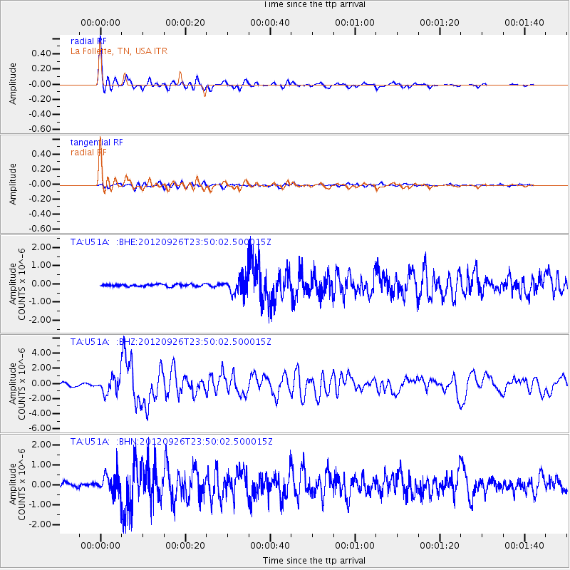
Earthquake location: Andreanof Islands, Aleutian Is.
Earthquake latitude/longitude: 51.6/-178.3
Earthquake time(UTC): 2012/09/26 (270) 23:39:55 GMT
Earthquake Depth: 16 km
Earthquake Magnitude: 6.3 MB, 6.5 MS, 6.4 MW, 6.4 MW
Earthquake Catalog/Contributor: WHDF/NEIC
Network: TA USArray Transportable Network (new EarthScope stations)
Station: U51A La Follette, TN, USA
Lat/Lon: 36.38 N/84.02 W
Elevation: 472 m
Distance: 64.9 deg
Az: 62.696 deg
Baz: 316.617 deg
Ray Param: 0.0586035
Estimated Moho Depth: 15.5 km
Estimated Crust Vp/Vs: 1.70
Assumed Crust Vp: 6.476 km/s
Estimated Crust Vs: 3.809 km/s
Estimated Crust Poisson's Ratio: 0.24
Radial Match: 94.61 %
Radial Bump: 356
Transverse Match: 75.52349 %
Transverse Bump: 400
SOD ConfigId: 478790
Insert Time: 2013-02-22 23:50:42.483 +0000
GWidth: 2.5
Max Bumps: 400
Tol: 0.001

Signal To Noise

ChannelStoNSTALTA
TA:U51A: :BHZ:20120926T23:50:02.500015Z7.37737561.1034822E-61.4957654E-7
TA:U51A: :BHN:20120926T23:50:02.500015Z4.3594915.149756E-71.1812747E-7
TA:U51A: :BHE:20120926T23:50:02.500015Z9.3962785.4530614E-75.8034264E-8
Arrivals
Ps1.8 SECOND
PpPs6.2 SECOND
PsPs/PpSs7.9 SECOND