T51A Gray, KY, USA - Earthquake Result Viewer
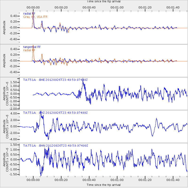
Earthquake location: Andreanof Islands, Aleutian Is.
Earthquake latitude/longitude: 51.6/-178.3
Earthquake time(UTC): 2012/09/26 (270) 23:39:55 GMT
Earthquake Depth: 16 km
Earthquake Magnitude: 6.3 MB, 6.5 MS, 6.4 MW, 6.4 MW
Earthquake Catalog/Contributor: WHDF/NEIC
Network: TA USArray Transportable Network (new EarthScope stations)
Station: T51A Gray, KY, USA
Lat/Lon: 36.97 N/83.95 W
Elevation: 329 m
Distance: 64.5 deg
Az: 62.204 deg
Baz: 316.449 deg
Ray Param: 0.05885193
Estimated Moho Depth: 40.75 km
Estimated Crust Vp/Vs: 1.97
Assumed Crust Vp: 6.476 km/s
Estimated Crust Vs: 3.291 km/s
Estimated Crust Poisson's Ratio: 0.33
Radial Match: 92.55173 %
Radial Bump: 388
Transverse Match: 79.017426 %
Transverse Bump: 400
SOD ConfigId: 478790
Insert Time: 2013-02-22 23:50:43.731 +0000
GWidth: 2.5
Max Bumps: 400
Tol: 0.001

Signal To Noise

ChannelStoNSTALTA
TA:T51A: :BHZ:20120926T23:49:59.97499Z7.9380059.657285E-71.2165884E-7
TA:T51A: :BHN:20120926T23:49:59.97499Z4.19551324.1379297E-79.8627496E-8
TA:T51A: :BHE:20120926T23:49:59.97499Z3.46536233.290383E-79.4950614E-8
Arrivals
Ps6.3 SECOND
PpPs18 SECOND
PsPs/PpSs24 SECOND