S49A Springfield, KY, USA - Earthquake Result Viewer
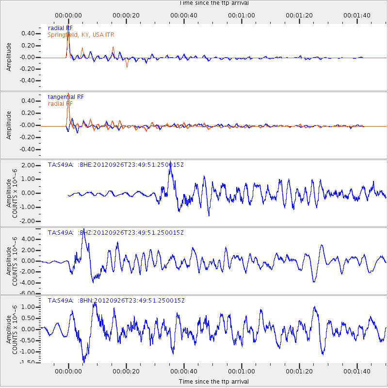
Earthquake location: Andreanof Islands, Aleutian Is.
Earthquake latitude/longitude: 51.6/-178.3
Earthquake time(UTC): 2012/09/26 (270) 23:39:55 GMT
Earthquake Depth: 16 km
Earthquake Magnitude: 6.3 MB, 6.5 MS, 6.4 MW, 6.4 MW
Earthquake Catalog/Contributor: WHDF/NEIC
Network: TA USArray Transportable Network (new EarthScope stations)
Station: S49A Springfield, KY, USA
Lat/Lon: 37.78 N/85.29 W
Elevation: 230 m
Distance: 63.2 deg
Az: 62.431 deg
Baz: 315.738 deg
Ray Param: 0.05972013
Estimated Moho Depth: 43.5 km
Estimated Crust Vp/Vs: 1.80
Assumed Crust Vp: 6.476 km/s
Estimated Crust Vs: 3.608 km/s
Estimated Crust Poisson's Ratio: 0.27
Radial Match: 95.07152 %
Radial Bump: 250
Transverse Match: 85.493164 %
Transverse Bump: 381
SOD ConfigId: 478790
Insert Time: 2013-02-22 23:51:12.891 +0000
GWidth: 2.5
Max Bumps: 400
Tol: 0.001

Signal To Noise

ChannelStoNSTALTA
TA:S49A: :BHZ:20120926T23:49:51.250015Z11.5747471.3386158E-61.15649684E-7
TA:S49A: :BHN:20120926T23:49:51.250015Z4.7296674.860377E-71.0276362E-7
TA:S49A: :BHE:20120926T23:49:51.250015Z4.31245764.5110482E-71.04605036E-7
Arrivals
Ps5.6 SECOND
PpPs18 SECOND
PsPs/PpSs24 SECOND