P50A Jamestown, OH, USA - Earthquake Result Viewer
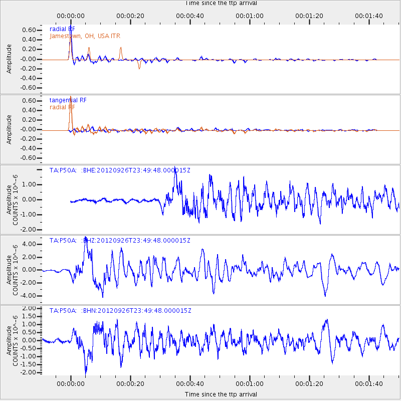
Earthquake location: Andreanof Islands, Aleutian Is.
Earthquake latitude/longitude: 51.6/-178.3
Earthquake time(UTC): 2012/09/26 (270) 23:39:55 GMT
Earthquake Depth: 16 km
Earthquake Magnitude: 6.3 MB, 6.5 MS, 6.4 MW, 6.4 MW
Earthquake Catalog/Contributor: WHDF/NEIC
Network: TA USArray Transportable Network (new EarthScope stations)
Station: P50A Jamestown, OH, USA
Lat/Lon: 39.61 N/83.80 W
Elevation: 318 m
Distance: 62.7 deg
Az: 60.066 deg
Baz: 315.589 deg
Ray Param: 0.060036235
Estimated Moho Depth: 13.0 km
Estimated Crust Vp/Vs: 1.94
Assumed Crust Vp: 6.232 km/s
Estimated Crust Vs: 3.216 km/s
Estimated Crust Poisson's Ratio: 0.32
Radial Match: 96.18287 %
Radial Bump: 207
Transverse Match: 83.50465 %
Transverse Bump: 400
SOD ConfigId: 478790
Insert Time: 2013-02-22 23:51:36.378 +0000
GWidth: 2.5
Max Bumps: 400
Tol: 0.001

Signal To Noise

ChannelStoNSTALTA
TA:P50A: :BHZ:20120926T23:49:48.000015Z14.6016961.3542752E-69.2747804E-8
TA:P50A: :BHN:20120926T23:49:48.000015Z6.61838964.879467E-77.372589E-8
TA:P50A: :BHE:20120926T23:49:48.000015Z7.1214845.16667E-77.255047E-8
Arrivals
Ps2.0 SECOND
PpPs5.9 SECOND
PsPs/PpSs7.9 SECOND