O48A Farmland, IN, USA - Earthquake Result Viewer
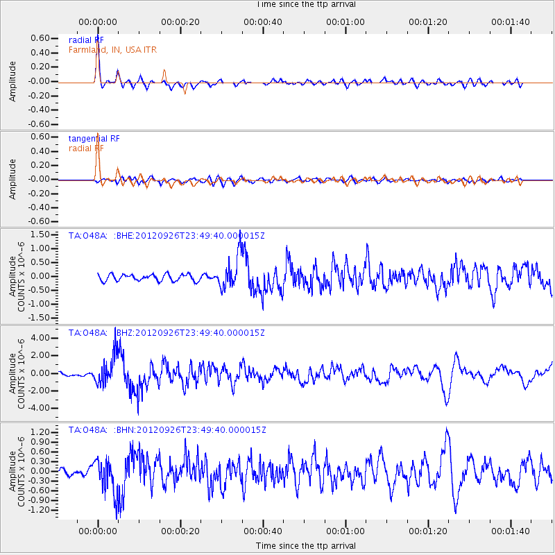
Earthquake location: Andreanof Islands, Aleutian Is.
Earthquake latitude/longitude: 51.6/-178.3
Earthquake time(UTC): 2012/09/26 (270) 23:39:55 GMT
Earthquake Depth: 16 km
Earthquake Magnitude: 6.3 MB, 6.5 MS, 6.4 MW, 6.4 MW
Earthquake Catalog/Contributor: WHDF/NEIC
Network: TA USArray Transportable Network (new EarthScope stations)
Station: O48A Farmland, IN, USA
Lat/Lon: 40.26 N/85.16 W
Elevation: 300 m
Distance: 61.5 deg
Az: 60.388 deg
Baz: 314.873 deg
Ray Param: 0.060811825
Estimated Moho Depth: 29.0 km
Estimated Crust Vp/Vs: 2.05
Assumed Crust Vp: 6.498 km/s
Estimated Crust Vs: 3.173 km/s
Estimated Crust Poisson's Ratio: 0.34
Radial Match: 91.027596 %
Radial Bump: 400
Transverse Match: 75.45668 %
Transverse Bump: 400
SOD ConfigId: 478790
Insert Time: 2013-02-22 23:52:02.613 +0000
GWidth: 2.5
Max Bumps: 400
Tol: 0.001

Signal To Noise

ChannelStoNSTALTA
TA:O48A: :BHZ:20120926T23:49:40.000015Z10.6115311.7268193E-61.6273046E-7
TA:O48A: :BHN:20120926T23:49:40.000015Z4.94771775.3190655E-71.07505436E-7
TA:O48A: :BHE:20120926T23:49:40.000015Z5.26780136.047131E-71.14794204E-7
Arrivals
Ps4.9 SECOND
PpPs13 SECOND
PsPs/PpSs18 SECOND