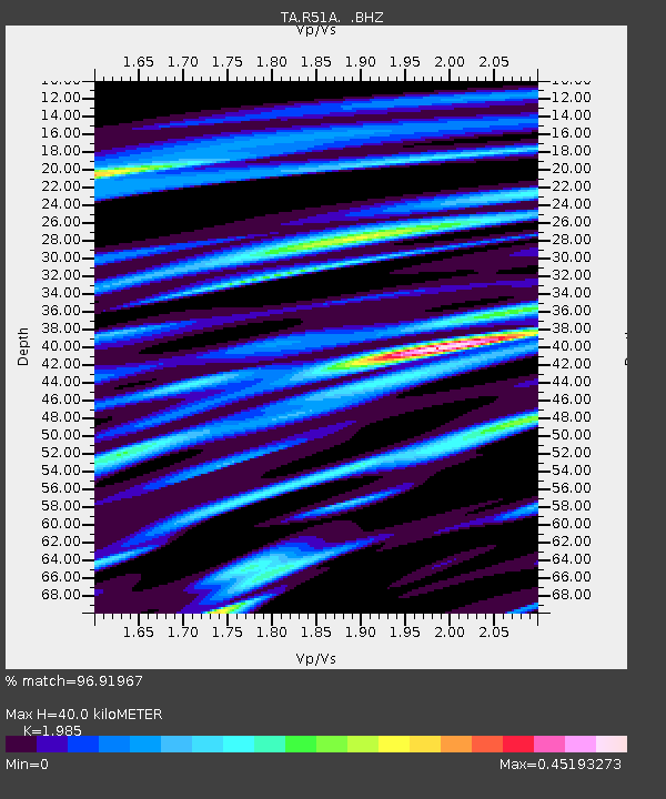
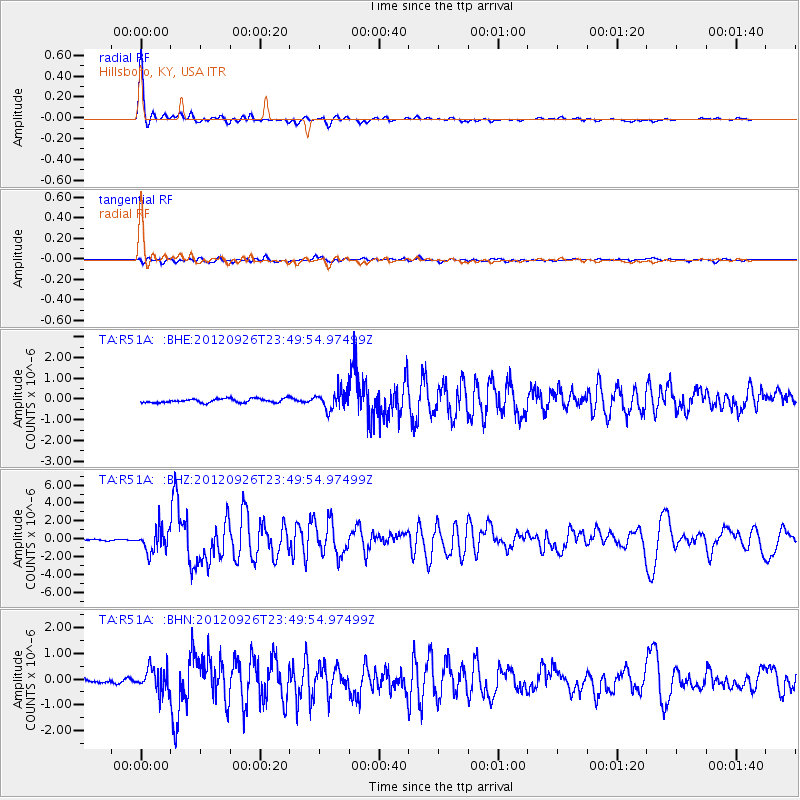
R51A Hillsboro, KY, USA - Earthquake Result Viewer

Earthquake location: Andreanof Islands, Aleutian Is.
Earthquake latitude/longitude: 51.6/-178.3
Earthquake time(UTC): 2012/09/26 (270) 23:39:55 GMT
Earthquake Depth: 16 km
Earthquake Magnitude: 6.3 MB, 6.5 MS, 6.4 MW, 6.4 MW
Earthquake Catalog/Contributor: WHDF/NEIC
Network: TA USArray Transportable Network (new EarthScope stations)
Station: R51A Hillsboro, KY, USA
Lat/Lon: 38.30 N/83.58 W
Elevation: 231 m
Distance: 63.8 deg
Az: 60.95 deg
Baz: 316.123 deg
Ray Param: 0.059352167
Estimated Moho Depth: 40.0 km
Estimated Crust Vp/Vs: 1.99
Assumed Crust Vp: 6.232 km/s
Estimated Crust Vs: 3.139 km/s
Estimated Crust Poisson's Ratio: 0.33
Radial Match: 96.91967 %
Radial Bump: 325
Transverse Match: 74.94844 %
Transverse Bump: 400
SOD ConfigId: 478790
Insert Time: 2013-02-22 23:52:19.422 +0000
GWidth: 2.5
Max Bumps: 400
Tol: 0.001

Signal To Noise

ChannelStoNSTALTA
TA:R51A: :BHZ:20120926T23:49:54.97499Z13.0640291.3067951E-61.0003002E-7
TA:R51A: :BHN:20120926T23:49:54.97499Z3.81470014.4902222E-71.1770839E-7
TA:R51A: :BHE:20120926T23:49:54.97499Z4.6339924.4445298E-79.591147E-8
Arrivals
Ps6.6 SECOND
PpPs18 SECOND
PsPs/PpSs25 SECOND