
R52A Catlettsburg, KY, USA - Earthquake Result Viewer
| ||||||||||||||||||
| ||||||||||||||||||
| ||||||||||||||||||
|
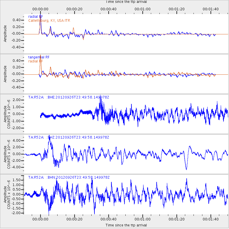
Signal To Noise
| Channel | StoN | STA | LTA |
| TA:R52A: :BHZ:20120926T23:49:58.149978Z | 14.621947 | 1.2334541E-6 | 8.4356344E-8 |
| TA:R52A: :BHN:20120926T23:49:58.149978Z | 3.505058 | 4.681648E-7 | 1.3356835E-7 |
| TA:R52A: :BHE:20120926T23:49:58.149978Z | 2.732868 | 6.416632E-7 | 2.347948E-7 |
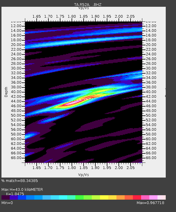
| Arrivals | |
| Ps | 6.1 SECOND |
| PpPs | 19 SECOND |
| PsPs/PpSs | 25 SECOND |

