M49A Liberty Center, OH, USA - Earthquake Result Viewer
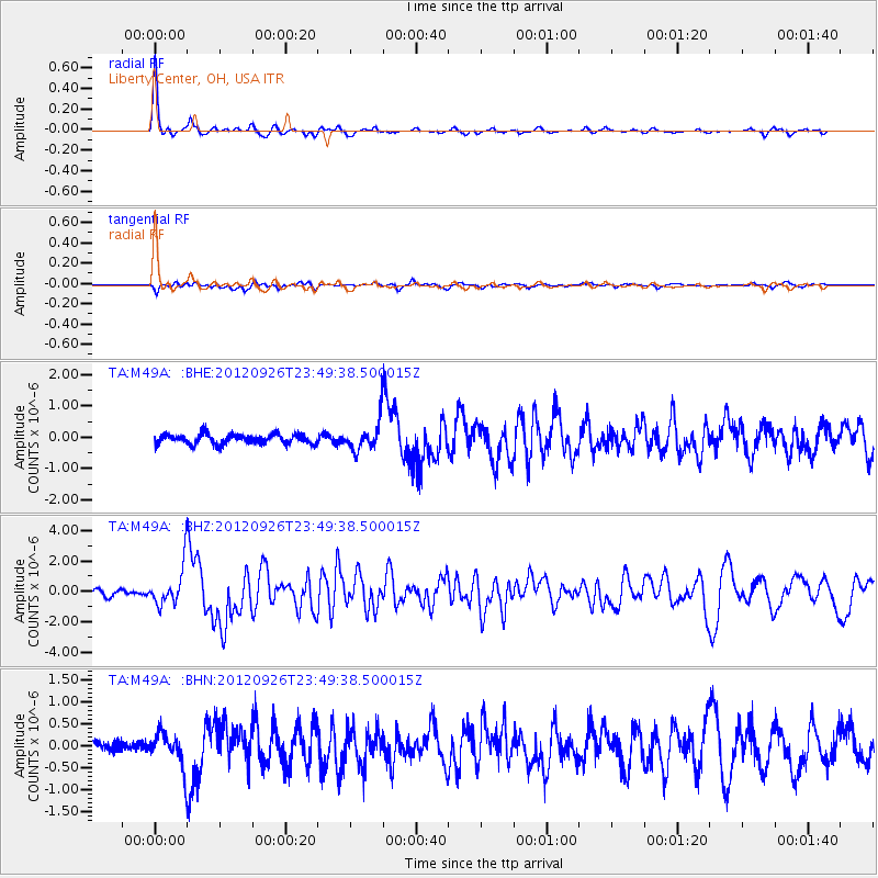
Earthquake location: Andreanof Islands, Aleutian Is.
Earthquake latitude/longitude: 51.6/-178.3
Earthquake time(UTC): 2012/09/26 (270) 23:39:55 GMT
Earthquake Depth: 16 km
Earthquake Magnitude: 6.3 MB, 6.5 MS, 6.4 MW, 6.4 MW
Earthquake Catalog/Contributor: WHDF/NEIC
Network: TA USArray Transportable Network (new EarthScope stations)
Station: M49A Liberty Center, OH, USA
Lat/Lon: 41.47 N/83.98 W
Elevation: 203 m
Distance: 61.3 deg
Az: 58.687 deg
Baz: 314.828 deg
Ray Param: 0.060954824
Estimated Moho Depth: 45.5 km
Estimated Crust Vp/Vs: 1.75
Assumed Crust Vp: 6.498 km/s
Estimated Crust Vs: 3.718 km/s
Estimated Crust Poisson's Ratio: 0.26
Radial Match: 96.50254 %
Radial Bump: 254
Transverse Match: 81.64875 %
Transverse Bump: 400
SOD ConfigId: 478790
Insert Time: 2013-02-22 23:52:39.885 +0000
GWidth: 2.5
Max Bumps: 400
Tol: 0.001

Signal To Noise

ChannelStoNSTALTA
TA:M49A: :BHZ:20120926T23:49:38.500015Z7.7182721.2877224E-61.6684076E-7
TA:M49A: :BHN:20120926T23:49:38.500015Z3.04575043.847733E-71.263312E-7
TA:M49A: :BHE:20120926T23:49:38.500015Z3.02351984.790672E-71.5844685E-7
Arrivals
Ps5.5 SECOND
PpPs18 SECOND
PsPs/PpSs24 SECOND