
L48A N Adams, MI, USA - Earthquake Result Viewer
| ||||||||||||||||||
| ||||||||||||||||||
| ||||||||||||||||||
|
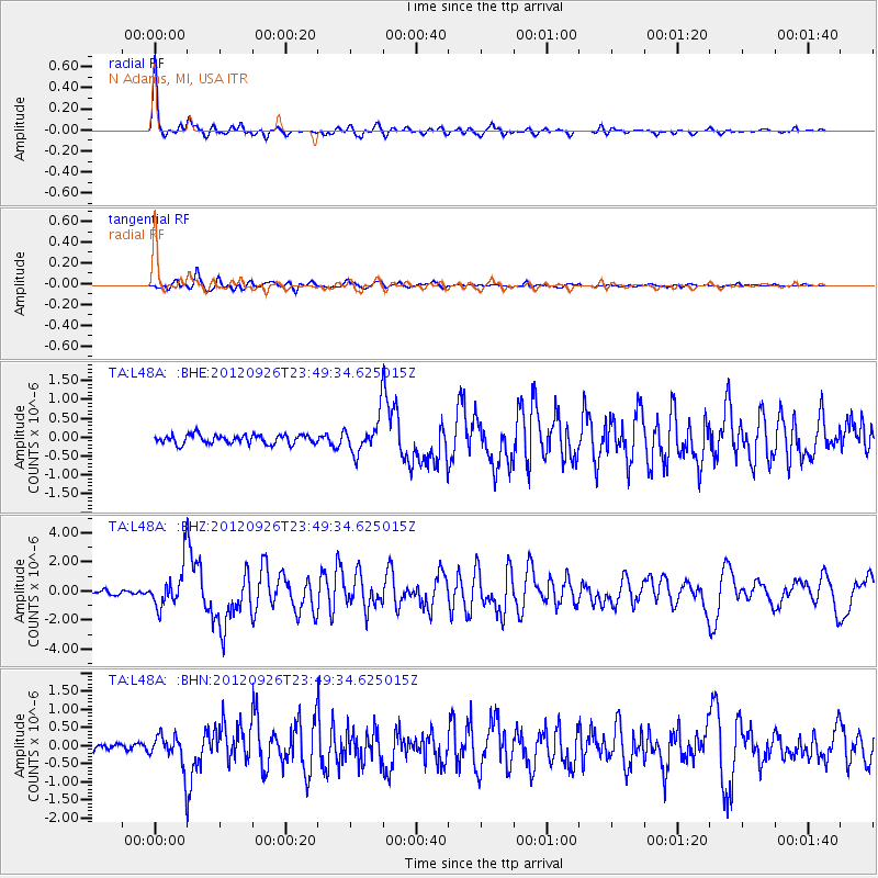
Signal To Noise
| Channel | StoN | STA | LTA |
| TA:L48A: :BHZ:20120926T23:49:34.625015Z | 8.533981 | 1.4223425E-6 | 1.6666812E-7 |
| TA:L48A: :BHN:20120926T23:49:34.625015Z | 3.173393 | 4.3344784E-7 | 1.3658813E-7 |
| TA:L48A: :BHE:20120926T23:49:34.625015Z | 4.047161 | 4.7962726E-7 | 1.1850956E-7 |
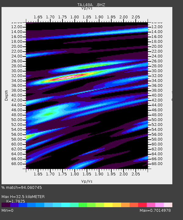
| Arrivals | |
| Ps | 4.0 SECOND |
| PpPs | 13 SECOND |
| PsPs/PpSs | 17 SECOND |

