P51A Williamsport, OH, USA - Earthquake Result Viewer
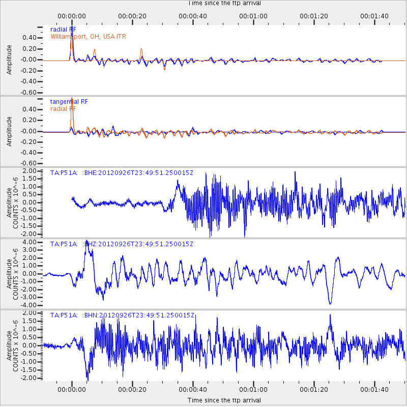
Earthquake location: Andreanof Islands, Aleutian Is.
Earthquake latitude/longitude: 51.6/-178.3
Earthquake time(UTC): 2012/09/26 (270) 23:39:55 GMT
Earthquake Depth: 16 km
Earthquake Magnitude: 6.3 MB, 6.5 MS, 6.4 MW, 6.4 MW
Earthquake Catalog/Contributor: WHDF/NEIC
Network: TA USArray Transportable Network (new EarthScope stations)
Station: P51A Williamsport, OH, USA
Lat/Lon: 39.48 N/83.06 W
Elevation: 211 m
Distance: 63.2 deg
Az: 59.706 deg
Baz: 315.894 deg
Ray Param: 0.05971947
Estimated Moho Depth: 53.25 km
Estimated Crust Vp/Vs: 1.84
Assumed Crust Vp: 6.232 km/s
Estimated Crust Vs: 3.391 km/s
Estimated Crust Poisson's Ratio: 0.29
Radial Match: 92.58282 %
Radial Bump: 371
Transverse Match: 81.25525 %
Transverse Bump: 400
SOD ConfigId: 478790
Insert Time: 2013-02-22 23:53:16.121 +0000
GWidth: 2.5
Max Bumps: 400
Tol: 0.001

Signal To Noise

ChannelStoNSTALTA
TA:P51A: :BHZ:20120926T23:49:51.250015Z11.4554371.306287E-61.1403206E-7
TA:P51A: :BHN:20120926T23:49:51.250015Z5.24292665.0969896E-79.721649E-8
TA:P51A: :BHE:20120926T23:49:51.250015Z3.33092884.245504E-71.2745706E-7
Arrivals
Ps7.4 SECOND
PpPs23 SECOND
PsPs/PpSs31 SECOND